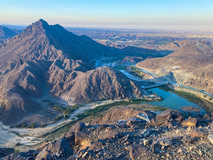
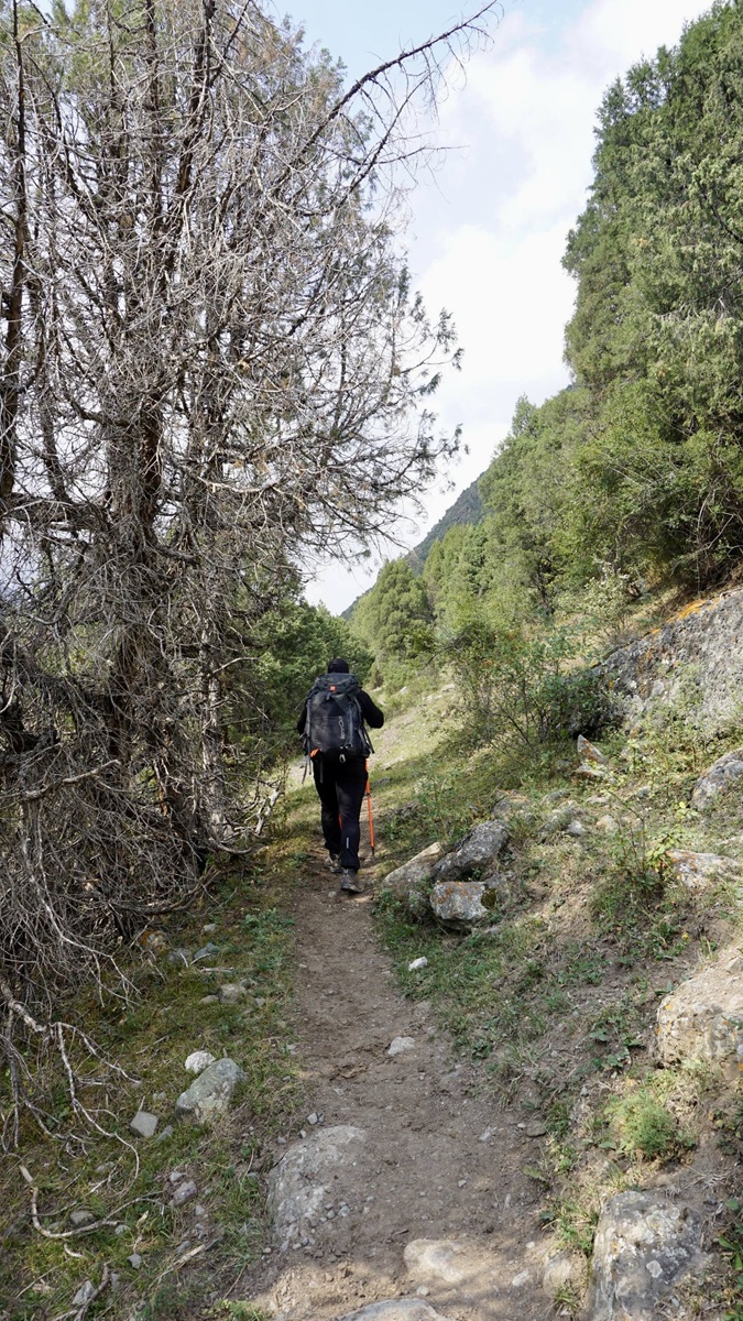
With only one week in Kyrgyzstan, I knew I wanted to hike somewhere accessible and low to acclimatize properly. Due to the ongoing construction in Ala Archa National Park, I didn't consider it as my first hiking destination. That's how I got convinced to finally hike the Alamedin Gorge in the Chuy Region. If you're looking for signs to hike it, let it be this post!
💡 Ready for more hiking adventures in Kyrgyzstan? Start exploring these trails now:
- Beginner-Friendly: Ala-Archa – Scenic Hike to Ratsek Hut
- Picture-Perfect: Kol-Tor Lake – A Turquoise Lake in Kegeti
- Glacier Adventure: Adygene Glacier Lake – Stunning high-alpine lake in Ala Archa Park
- Epic Challenge: Komsomolets Peak – Conquer a 4000er in one day!
ALAMEDIN GORGE HIKING Trail Overview:
- Route: Alamedin Gorge Loop Hiking Trail
- Distance: 15.17 km
- Elevation Gain: ±514 m
- Highest Point: 2,100 MASL
- Difficulty: Easy (1/5)
- Time Required: 3-5 hours (depending on your pace)
- Best Season: June to September
- Highlights: Green valleys, Waterfalls, Gorge views
How to get there and how to get out?
As mentioned in my Ala Archa Hike to Ratsek Hut post, while taking a marshrutka is usually possible around Bishkek, and even across Kyrgyzstan, I recommend arranging your transfers in advance instead. Public transportation can take a significant amount of time and energy — time you’d probably rather spend in the mountains.
If you decide to arrange a transfer ahead of time, ask your driver to drop you off or pick you up at the coordinates below:
Alamedin Gorge Parking Lot
📍 42.605615, 74.663433
(Click the coordinates to open the location in Google Maps.)
During our hike in August 2025, we paid the following fares:
- Bishkek to Alamedin (via Yandex): 1,300 som
- Alamedin to Bishkek (private contact with extra waiting time): 1,600 som
These fares were slightly higher because both drivers waited for us for some time. However, considering inflation, these prices may now reflect the typical cost of transportation to and from Alamedin Gorge.
Hiking Trailhead:
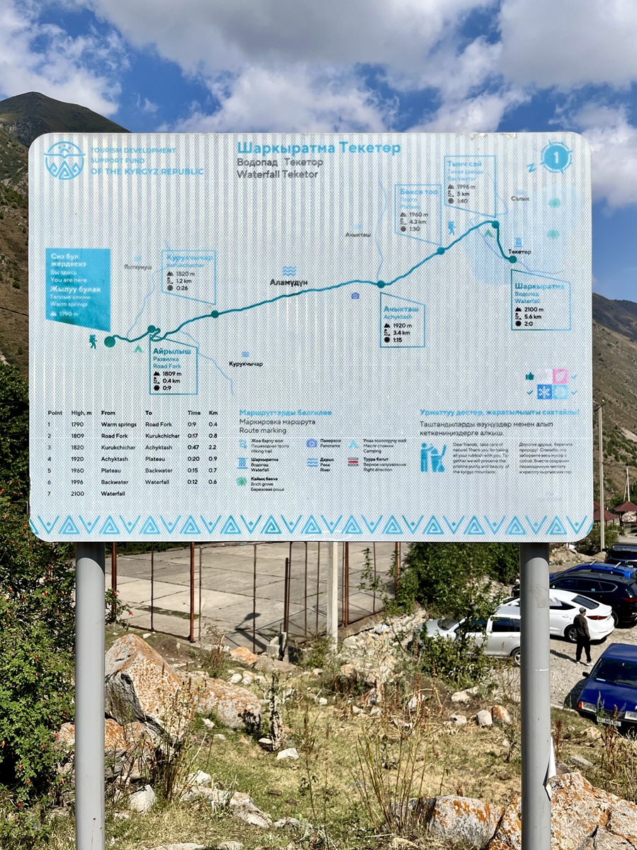
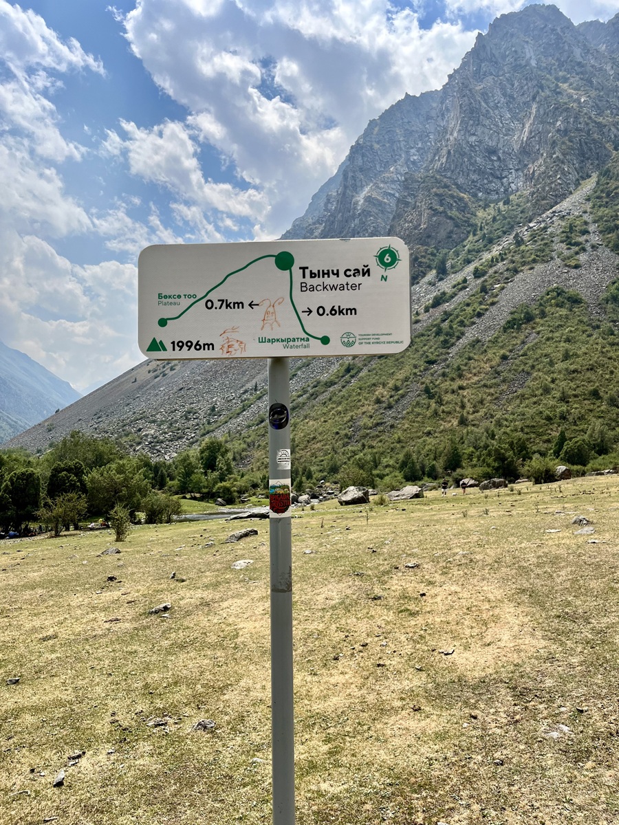
Located just a few meters ahead of the parking lot, you will find the trail map below, which indicates the official start of the trail. The map shows the official route leading to Teketor Waterfall or Waterfall Alamedin in Google Maps, a popular short hike in Alamedin Gorge, and one of the highlights of this loop hike.
You can also refer to the map for camping spots, springs, bridges, and scenic viewpoints, as the route is maintained by the Tourism Development Support Fund of the Kyrgyz Republic.
You’ll also notice several guesthouses, resorts, and sanatorium-style accommodations around the trailhead area. Many visitors stay overnight here to enjoy the cooler mountain climate and easy access to the hiking trails in Alamedin Gorge.
However, since the hike to Teketor Waterfall is a bit shorter than our hiking appetite, we decided to turn it into a loop hike instead. This means you will start and finish your hike at the same trailhead — the parking lot.
Hiking Trail Sections:
Since the hike is relatively short, I’ve divided the trail into a few sections using notable landmarks that are easy to follow on the trail map. This should help you visualize the route and navigate the loop more easily.
Just a quick note: we completed the hike in a counterclockwise direction, starting on the right side of Alamedin Gorge (if you’re facing toward the waterfall side, which is roughly north).
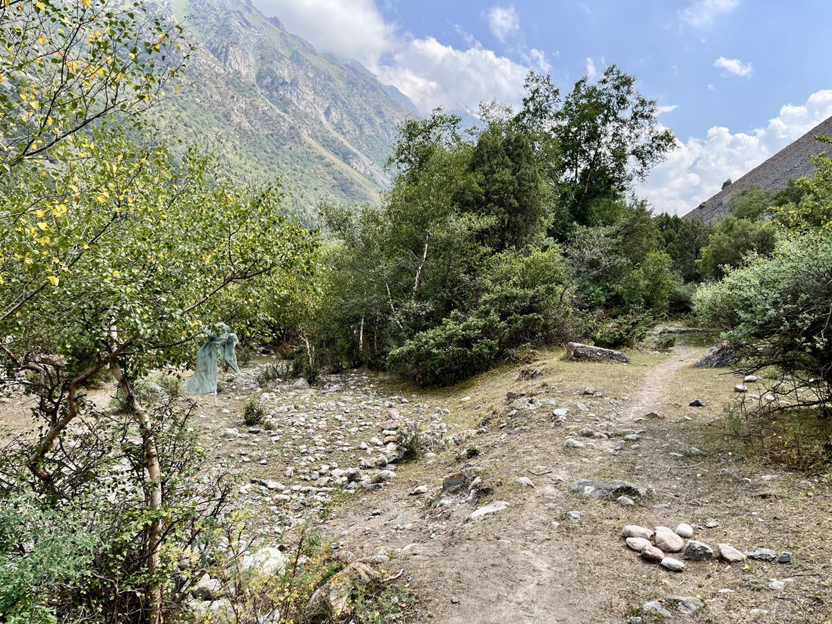
1. Trailhead to Kurukchychar
From the parking lot, we followed the same road that led us to the Road Fork. This is the point where you need to decide which side of the gorge to hike first. Since we hiked the trail counterclockwise, we took the right side of the gorge, following the path on the right (next to the yurt as seen below).
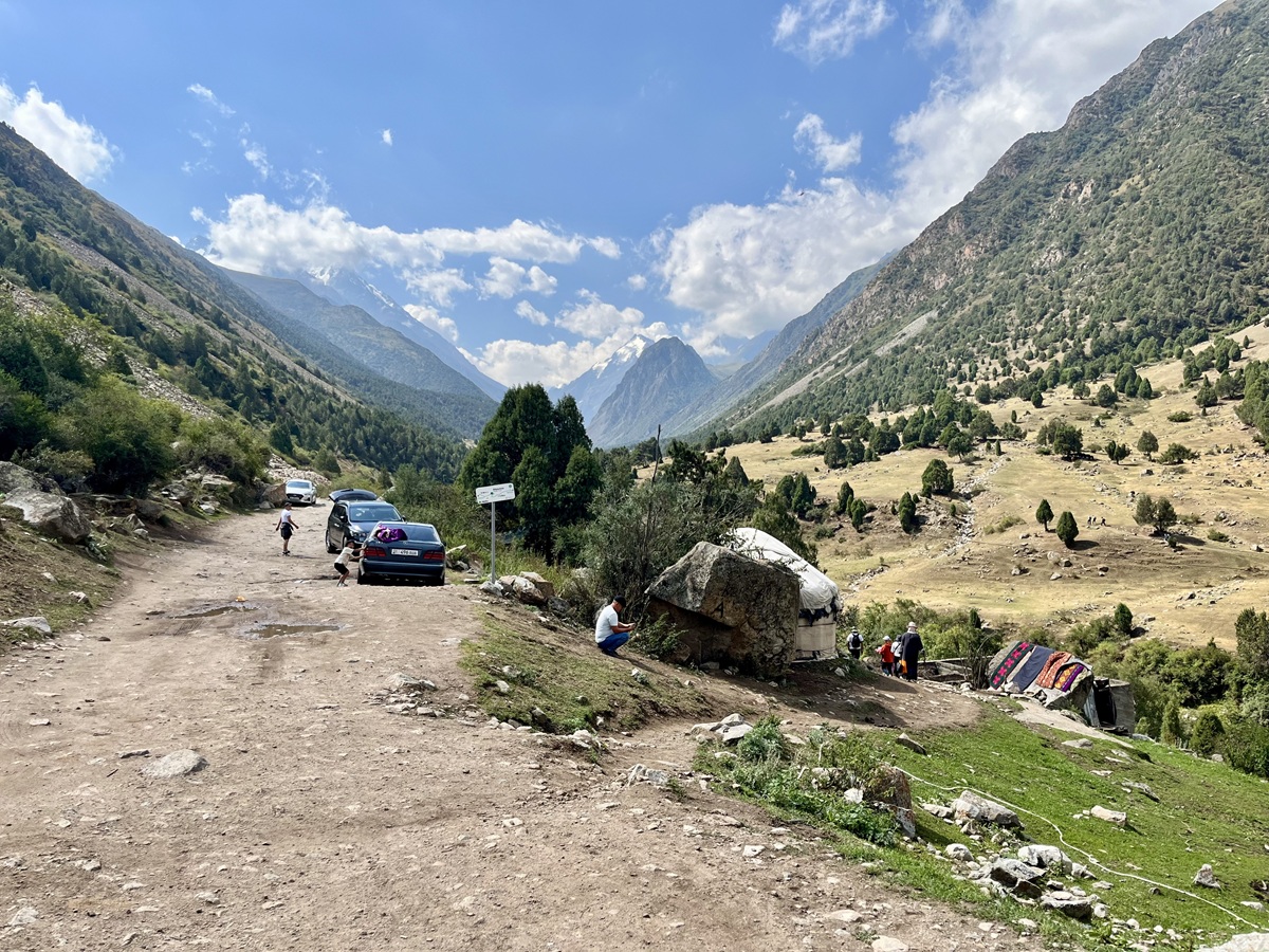
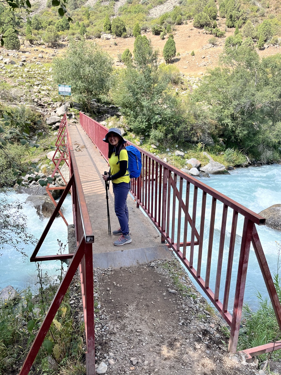
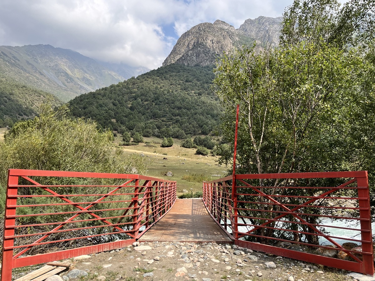
Continue walking a bit further downhill until you spot a red metal bridge. Take this bridge to cross the Alamedin River.
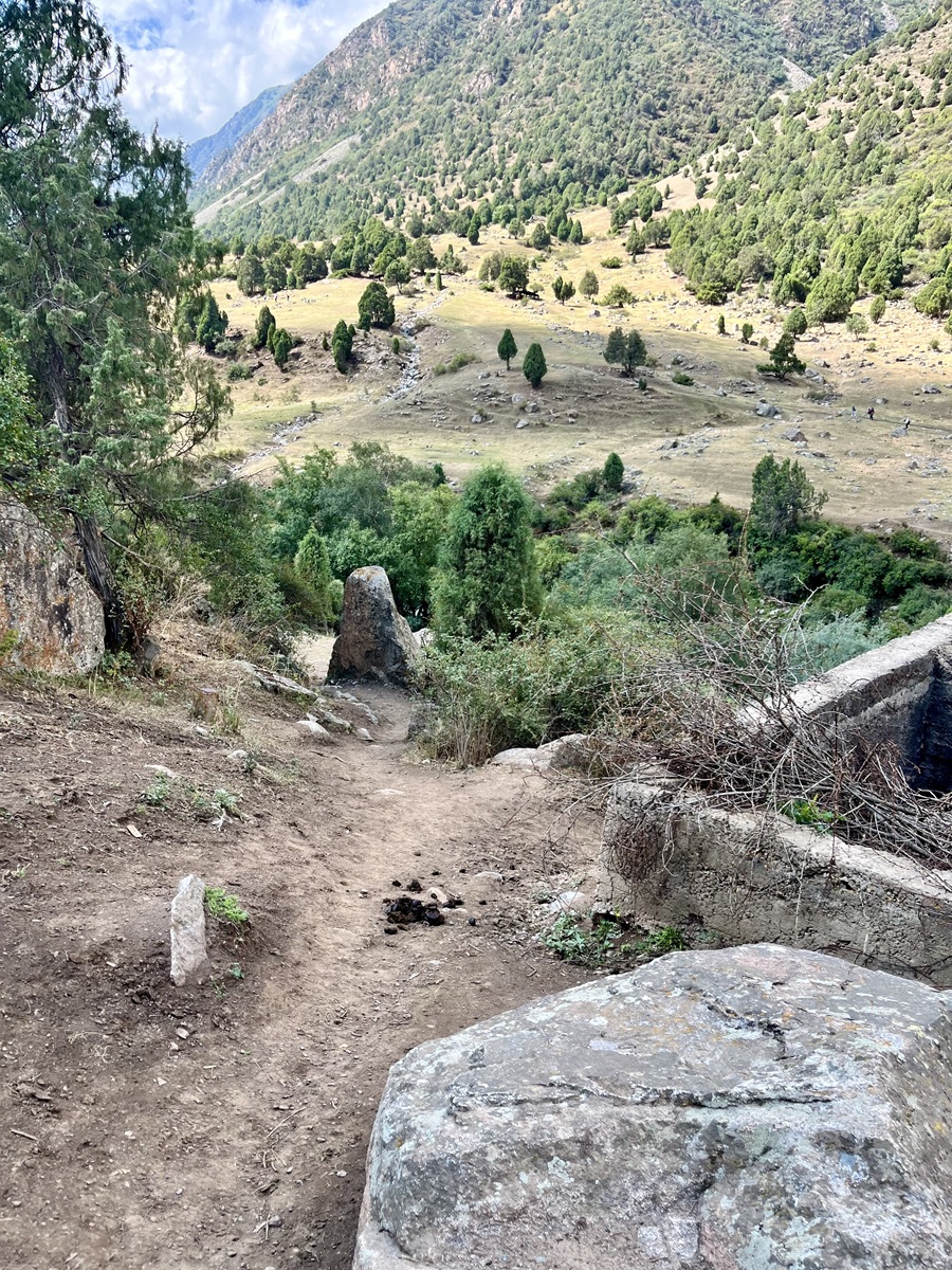
Once you cross the river, you’ll begin your hike along the right side of the valley. From here, the views of the surrounding mountains begin to open up as you slowly leave the resort area behind.
This area is also commonly used for animal grazing, so you’ll likely encounter cows and horses along the way — and of course, the occasional animal droppings on the trail. It’s completely normal in this part of Kyrgyzstan, but something to keep in mind if you’re a bit fussy about where you step.
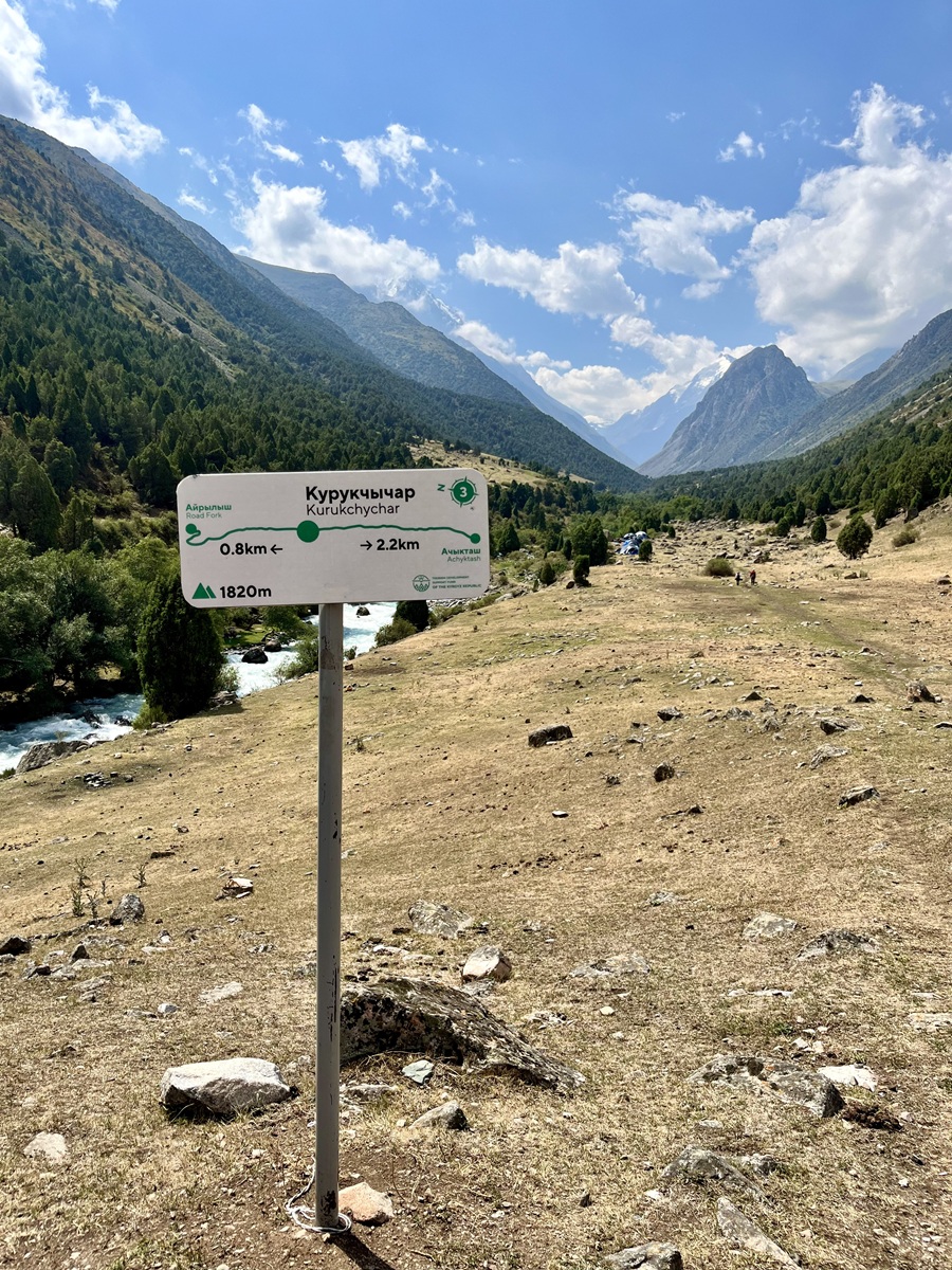
2. Kurukchichar to Achyktash and the Plateau
Although it is not clearly marked on the official trail map, we noticed several pitched tents in this section. I guess it’s true when people say you can camp almost anywhere in Kyrgyzstan, as long as you’re not too close to water sources.
After passing the campers, the hike continued with a gentle walk deeper into the gorge.
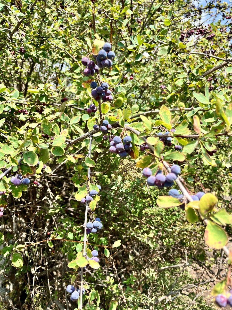
Along the way, we also spotted several wild berries growing beside the trail. While I’m not entirely sure what variety they were, I heard they are edible and commonly found during the summer season, especially in open meadows and along forest edges.
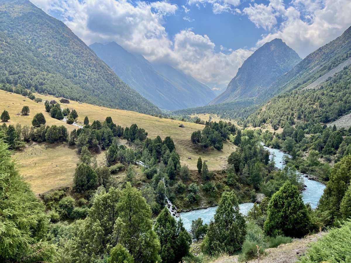
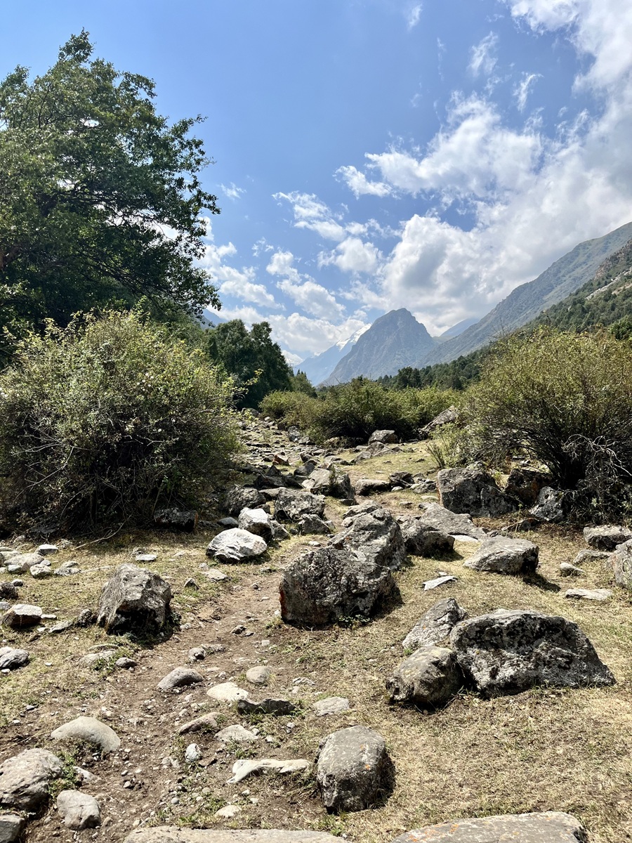
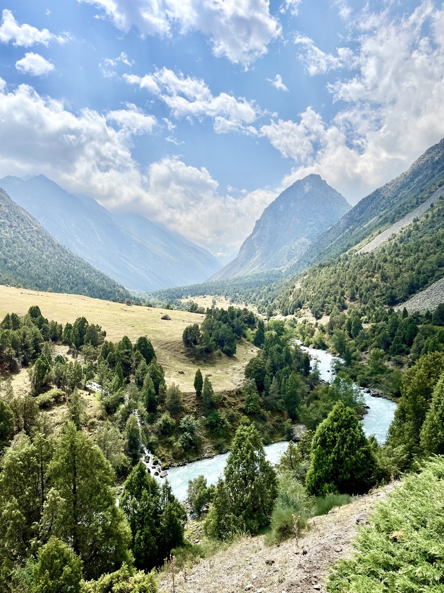
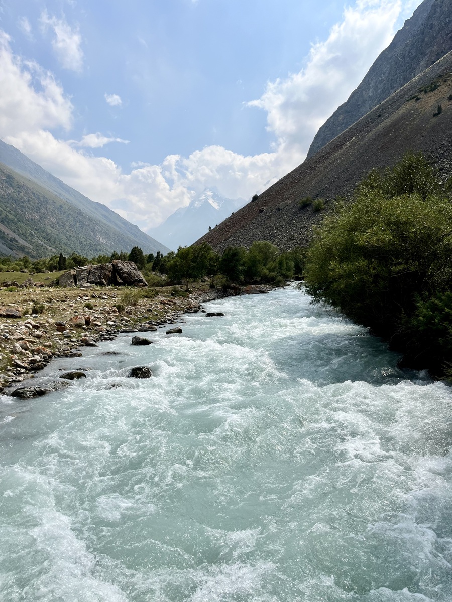
Soon enough, we reached Achyktash, where the view suddenly opened up to its full glory, revealing the entire gorge with magnificent mountains as its backdrop. The Alamedin River rushed through the valley with its clear blue water, and the greenery was an absolute feast for my eyes — especially coming from the UAE, where lush landscapes are quite rare.
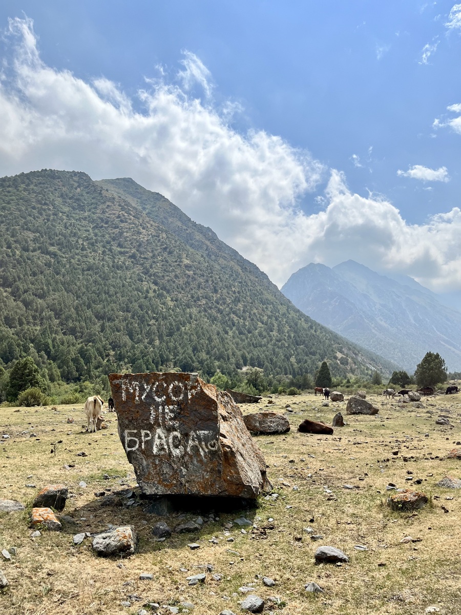
After spending a long moment taking in the view and countless photo ops, we finally continued our walk toward the plateau. It’s not particularly large nor very obvious, but a large rock covered with vandal writings is something you won’t miss in this section. During our hike, this was also where several cows were resting, although that might depend on the time of day.
3. Plateau to Teketor Waterfall
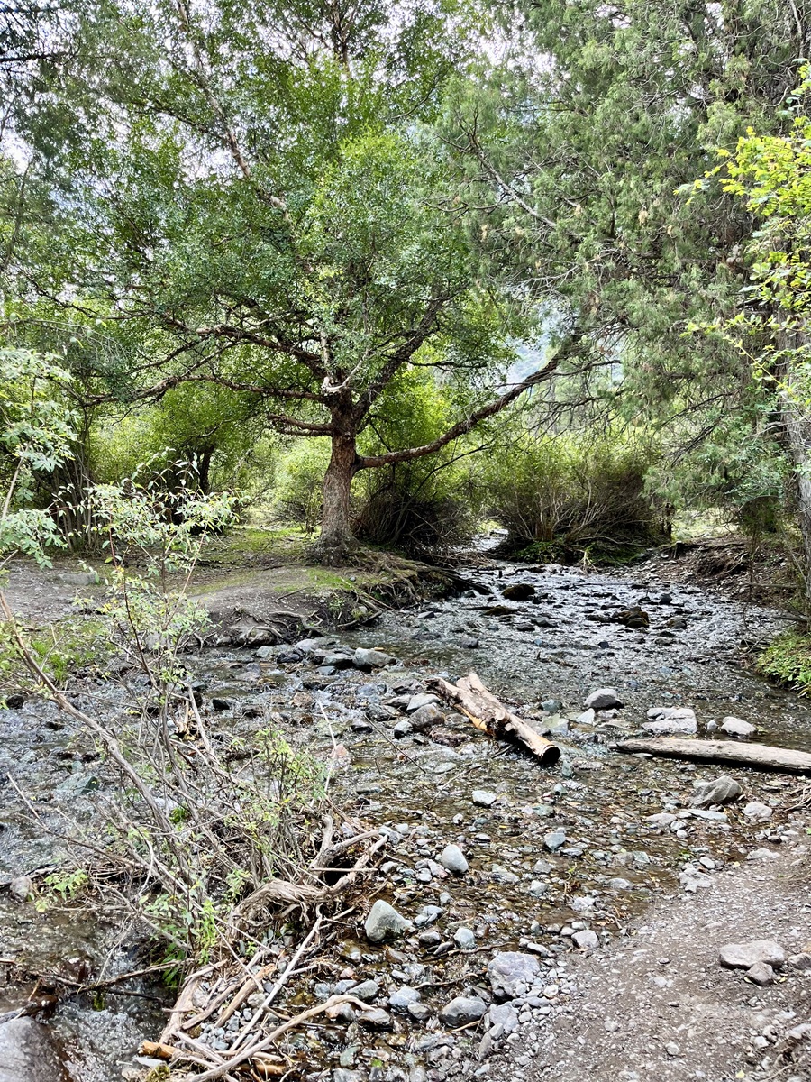
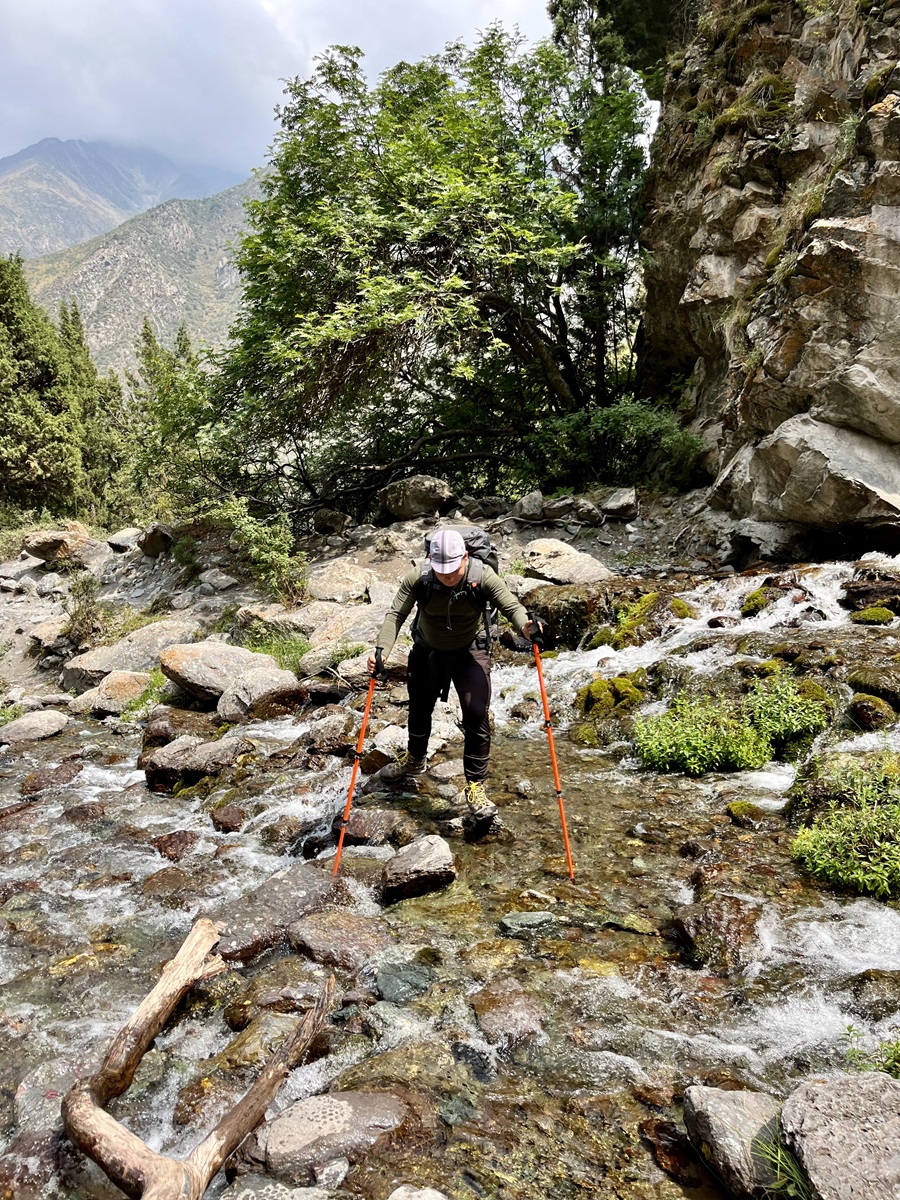
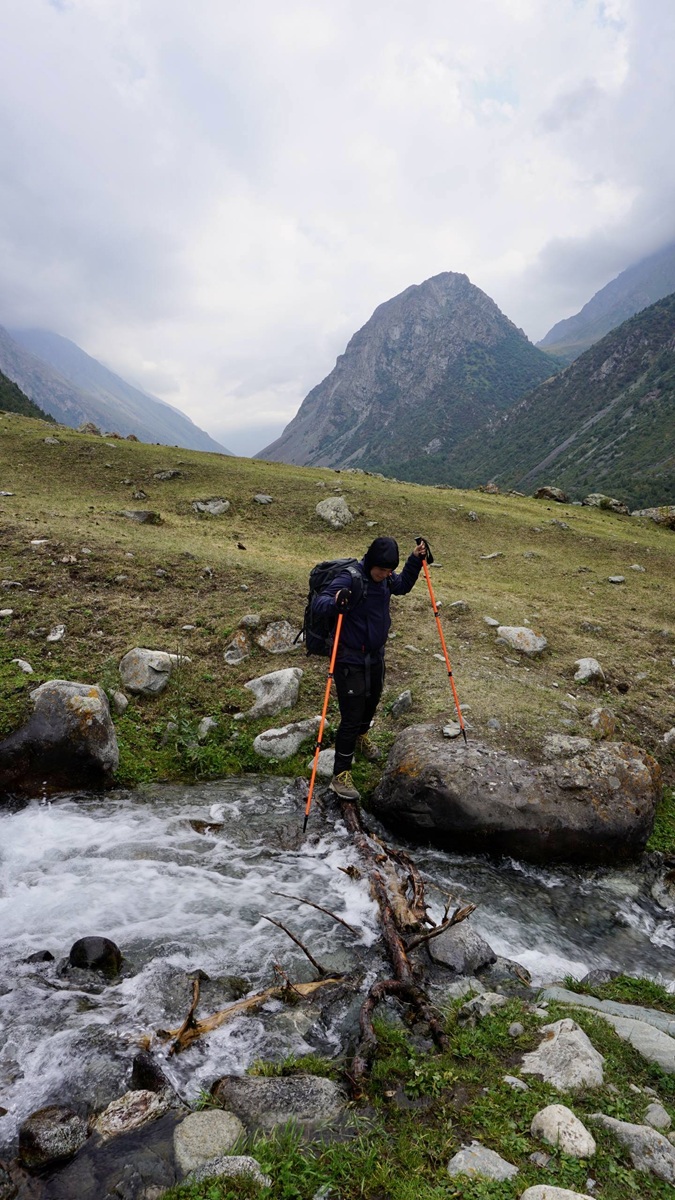
From the plateau, the trail continued through a small wooded section before reaching a shallow stream. We were able to cross it easily by stepping on a few branches and rocks that were probably placed there by other hikers.
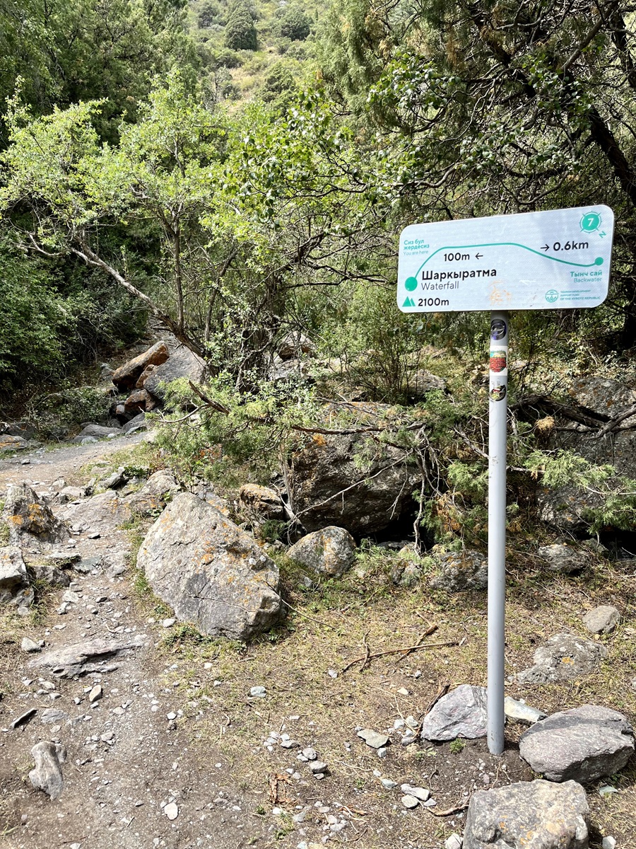
Shortly after the crossing, we arrived at a small clearing — an open area with several campers pitching their tents near the stream. I assumed this is what the trail map refers to as the Backwater.
In this section, we turned right and started hiking uphill toward Teketor Waterfall. Another sign appeared along the trail as we entered the woods again. Just a few minutes later, we spotted the stream fed by the waterfall, which was a clear sign that we were getting very close.
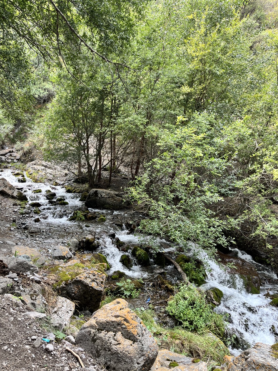
Surprisingly, we realized that we had to cross the stream to reach the waterfall itself. While the current wasn’t particularly strong, the rocks were quite slippery. My hiking boots weren’t exactly that waterproof (I was wearing the Columbia Women’s Peakfreak™ II Mid Outdry — great for casual hiking but probably not ideal for stream crossings). So we carefully made our way across step by step using the rocks, with the support of our trekking poles.
Gear used (click below for gear reviews!):
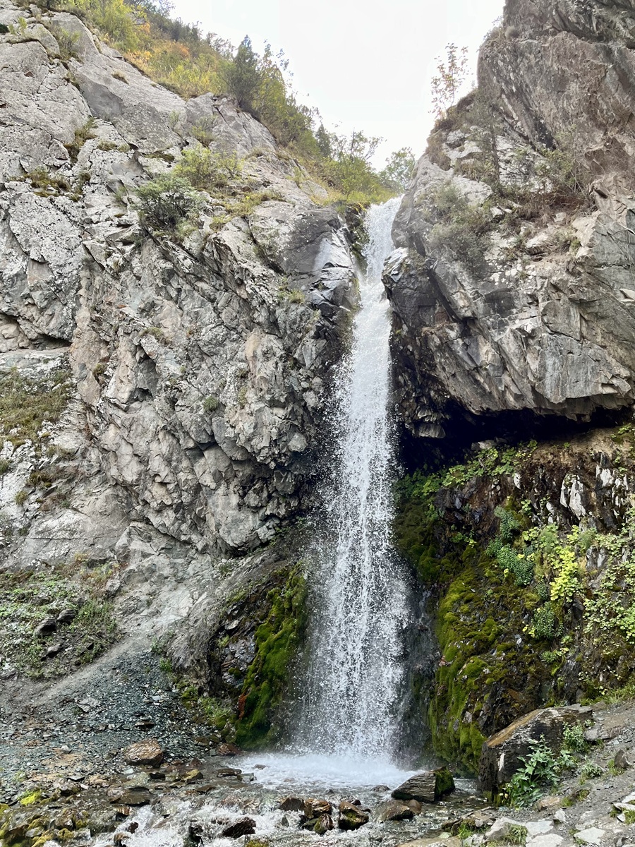
At the end of the gorge, we finally reached the 14-meter Teketor Waterfall. My photos don’t really do justice to its size, but I was honestly surprised and impressed when I saw it in person. The cool water cascading down the rocks created a refreshing breeze, which felt amazing after hiking in the warm summer weather.
We decided to take a break here and enjoy some snacks for a light lunch before continuing our loop hike.
4. Teketor Waterfall to Salyk River
Now onto the second half of our trail to complete the loop. After spending some time at Teketor Waterfall, we made our way down and walked back toward the Backwater.
Another crossing awaited us here — this time across the backwater stream. There wasn’t an obvious crossing point, so we had to find the most shallow section with stable stones to step on. This crossing was a bit longer than the previous ones, and the rocks were quite slippery, which made me slightly nervous about slipping midway.
After crossing, we were back walking through the woods for a short while until we reached a fork marked by a plastic ribbon tied to a tree, likely placed there as a signal not to continue straight ahead. Although the trail continues further into the gorge, we turned left to stay on the loop route.
Soon after, we reached another red metal bridge crossing the Alamedin River. This bridge does not appear on most online maps yet, but it was clearly visible on the ground with the river raging below.
After crossing the bridge, we continued walking past four large stones and gradually climbed toward the higher plateaus. On this side of the gorge, several faint trails were branching out, but don’t worry — most of them eventually merge again.
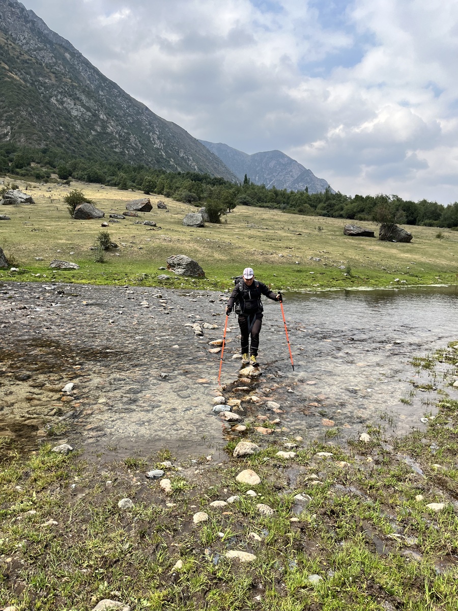
The trail then passed through open meadows until we reached another water crossing, which we believe was the Salyk River.
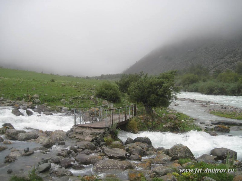
This was probably the strongest current we encountered during the hike, but thankfully, a wooden bridge had been installed across the stream. Unfortunately, we didn’t manage to take a photo of this bridge, so we are borrowing the image above from the Sports Tourism Federation of Dmitrovsky District website.
5. Salyk River to Trailhead
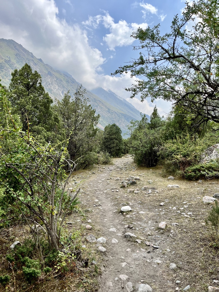
From the Salyk River, we continued along the opposite side of the valley, gradually making our way back toward the lower part of Alamedin Gorge.
This side of the gorge felt much quieter and more peaceful. In fact, we didn’t even encounter any other hikers along this section, although it may be because it was already getting late in the afternoon.
We also crossed one final stream (by this point we had already lost count), just as the weather suddenly turned gloomy and rain looked ready to pour down. Because of that, we rushed through the last part of the trail, which is why we don’t have many photos from this section.
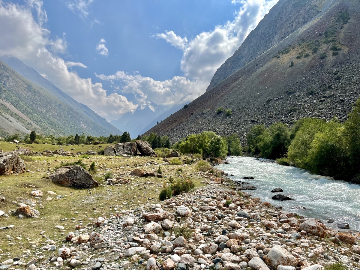
The scenery here remained similar, with the other side of the gorge clearly visible across the valley, which also helped us confirm we were still on the correct route. Toward the end, the trail briefly passed through an area with some large rocks. I’m not entirely sure if they are natural or related to some construction work nearby.
Past this short rocky section, the trail eventually led us back to the same road near the village. We were reconnected with the road fork on the left side, and finally completed our Alamedin Gorge loop hike.
Hiking Arrangements & Contact Groups:
You can definitely hike this trail on your own since it’s well-established and easy to follow. However, if you prefer hiking with a guide (which I personally recommend), here are some contacts I had a great experience with. The links below lead to their Instagram accounts — feel free to reach out directly:
- Beka @kyrgyzgirl__ from @BeNomad. Not only can she arrange the guide, but also transportation and other tours around Kyrgyzstan.
- Guides Jamil & Nurbolot and both of them are affiliated with the Trekking Union of Kyrgyzstan. They are amazing and professional guides, and I can't thank them enough for their knowledge and service.
If you’re only looking for transportation arrangements, you can contact the person below who arranged our transport in Kok Moinok Canyon:
👤 Ms. Nuri
📱 +996-500-205030
🔗 Facebook Profile
BONUS: More Stunning Landscapes in Kyrgyzstan
If you're not planning to do many serious hikes but still want to experience Kyrgyzstan’s breathtaking landscapes, these destinations offer incredible scenery with minimal trekking.
- Skazka (Fairytale) Canyon – a colorful canyon near Issyk Kul, famous for its dramatic, colorful rock formations.
- Jeti Oguz - The Famous Seven Bulls Rock – one of Kyrgyzstan’s most iconic red sandstone formations.
- Kok Moinok Canyon – a lesser-known canyon with unique rock formations and peaceful trails.
- Son Kul Lake – a stunning alpine lake where travelers can experience traditional nomadic life.
While Alamedin Gorge offers a fun hiking experience near Bishkek, these destinations showcase the diverse landscape across Kyrgyzstan, which you will never regret visiting.
Personal Thoughts on Alamedin Gorge Loop Hiking Trail:
As I always say, we all have different adventure appetite or what I call #hikeppetite to begin with. So, a good trail for me might not be a good trail for you, and vice versa. And that’s completely okay — we don’t need to agree with anyone or everyone all the time. Anyhow, here’s what I think about our hike in Alamedin Gorge:
Pros:
- The trail is well-established and easy to follow. It is not required to hire a guide, although there’s nothing wrong with doing so if you prefer the extra safety.
- Given the overall distance and relatively low elevation gain, the Alamedin Gorge hike is a popular choice from Bishkek, especially for casual hikers and tourists.
- While it may not be very high in elevation, it’s a perfect training hike — especially if you’re targeting a higher mountain and don’t have access to elevated terrain in your home country.
Cons:
- Like almost everywhere in Kyrgyzstan, public transportation can be a bit of a challenge. Getting to the trailhead by marshrutka is probably possible, but may not be the most time-efficient option. Taking a taxi or arranging a private transfer (like what we did) is the most comfortable choice, though not the most budget-friendly.
- If you’re looking for a more challenging hike, this loop may feel too easy. However, you can always extend your adventure by continuing deeper into the gorge.
While I enjoyed our hike in Alamedin Gorge, it felt a bit too easy and short for my appetite. However, since I’m based in the UAE and don’t have year-round access to the mountains, this hike was more than enough to prepare us for our main goal — the Adygene Glacier in Ala Archa National Park. So, who am I to complain? A hike is a hike!
Whatever decision you make, always remember to prepare beforehand, stay safe, and last but not least, enjoy the outdoors! #happyhiking!
With lots of love,
PINAYHAKAWATI 💗
AND AS A GENTLE OUTDOOR ETHICS REMINDER:
LEAVE NO TRACE!