The Komsomolets Peak hike in Ala Archa National Park is one of the most accessible 4000m peaks in Kyrgyzstan. If you're looking for a challenging day hike near Bishkek, this trail offers steep ascents, high altitude, and rewarding panoramic views.
Komsomolets Peak Trail Overview & Quick Facts:
- Route: Komsomolets Peak Trail (Out-and-back) in Ala Archa National Park
- Distance: 17.57 km
- Elevation Gain: ±2,049 m
- Highest Point: 4,204 MASL
- Difficulty: Challenging (Not Beginner-Friendly)
- Time Required: 10-13 hours (I took 14h 51m – I'm on a slower side)
- Best Season: June to September
- Highlights: Scenic view of Ala Archa and nearby peaks, steep slopes, and Violet Pass
How to Get to Ala Archa National Park from Bishkek (2025 Update)
Back in 2022 and 2024, I recommended arranging a private transfer or taxi, because taking a marshrutka (minibus) would only get you as far as the main gate. From there, you’d still have to cover another 12 km—either by car or on foot—to reach Alplager (Ala Archa Hotel), the starting point for most hiking trails.
As of August 2025, things have changed for the better! You can now easily book a Yandex taxi directly from Bishkek to the park entrance — the beautiful building (pictured below) with white buses in the parking lot next to it.
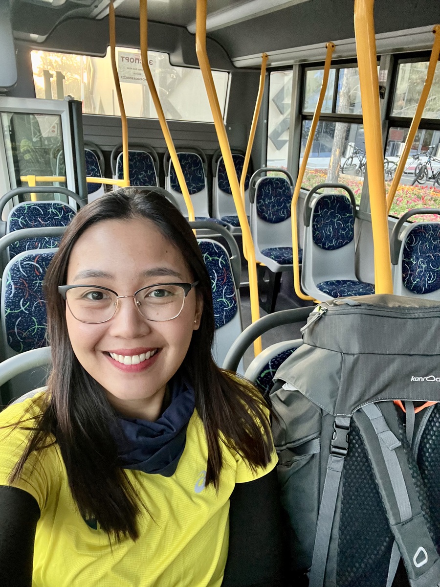
There's also a new public bus service from Bishkek with several pickup points, for just KGS 50 per person. It runs directly to Ala Archa’s main gate and operates from 8 AM (first bus from Bishkek) to 8 PM (last bus from the park). It’s an affordable option for solo travelers or small groups, though the schedule is less flexible than taxis.
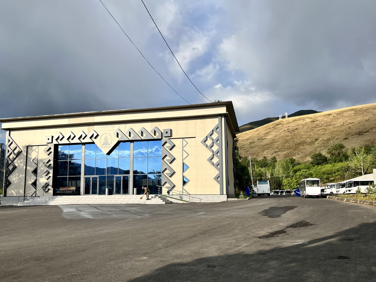
The main entrance has been renovated and is now equipped with card payment machines, eliminating the long single-file queue at the previous entrance. Best of all, free shuttle buses now run from the main entrance to Alplager throughout the day—a game-changer for hikers!
However, for families traveling with their own vehicle, you will be required to leave your car at the designated parking lot and take the shuttle bus. It’s a small hassle, but this system seems to be common in high-traffic national parks around the world—including some in the U.S.—to reduce congestion and protect natural areas.
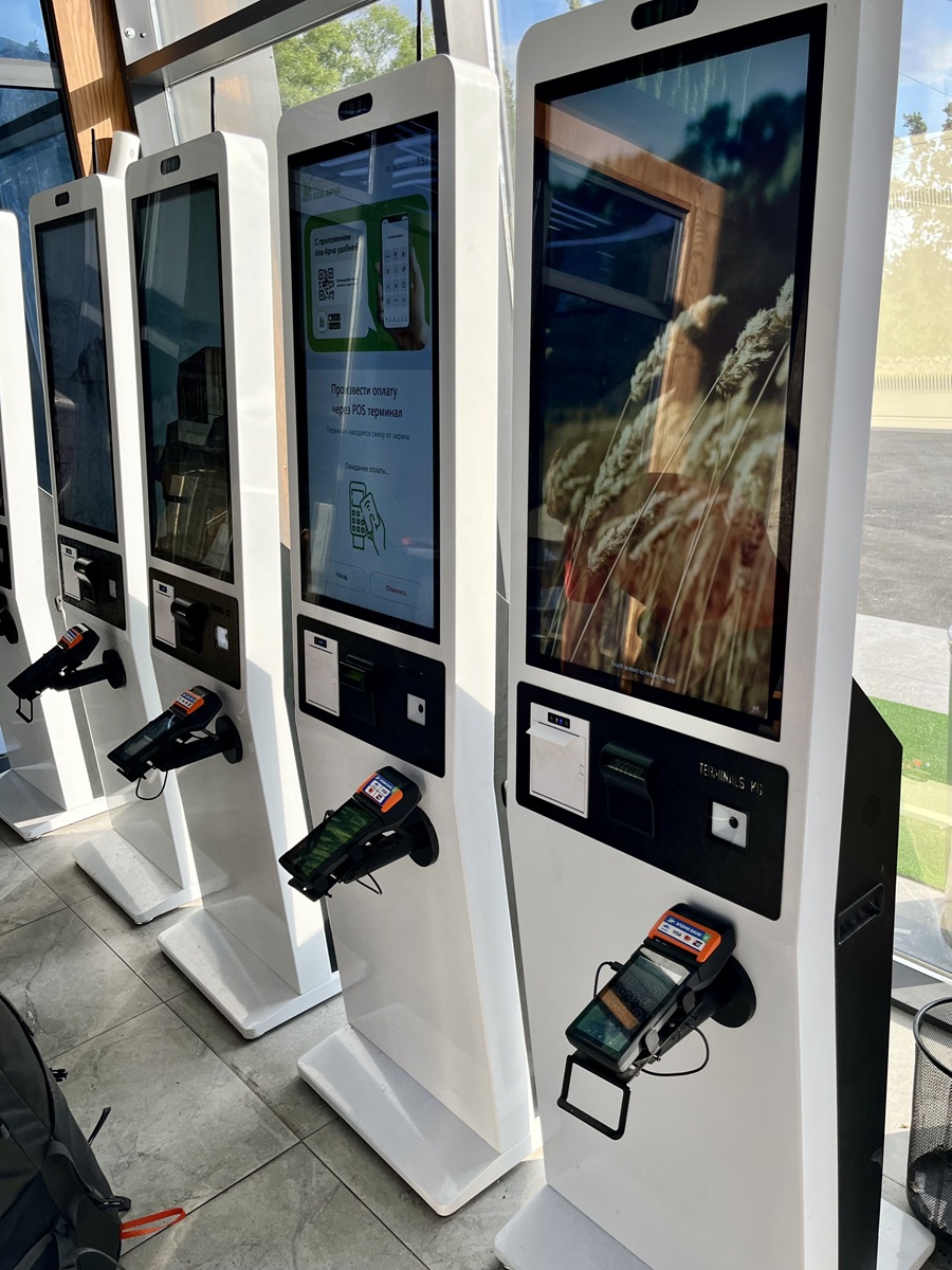
And can we take a moment to admire the new interior design at the entrance building? It honestly feels like walking into a modern alpine museum. They went all in on the upgrade, and I’m absolutely here for it!

Current Costs (2025):
- Entry Fee: 200 KGS per person (previously 500 KGS per vehicle)
- Bus Fare: 50 KGS per person per way
- Taxi Fare: One-way from Bishkek city center now costs 1,500–1,700 KGS, depending on your exact location—much cheaper than before when fares ranged from 3,000 to 4,000 KGS.
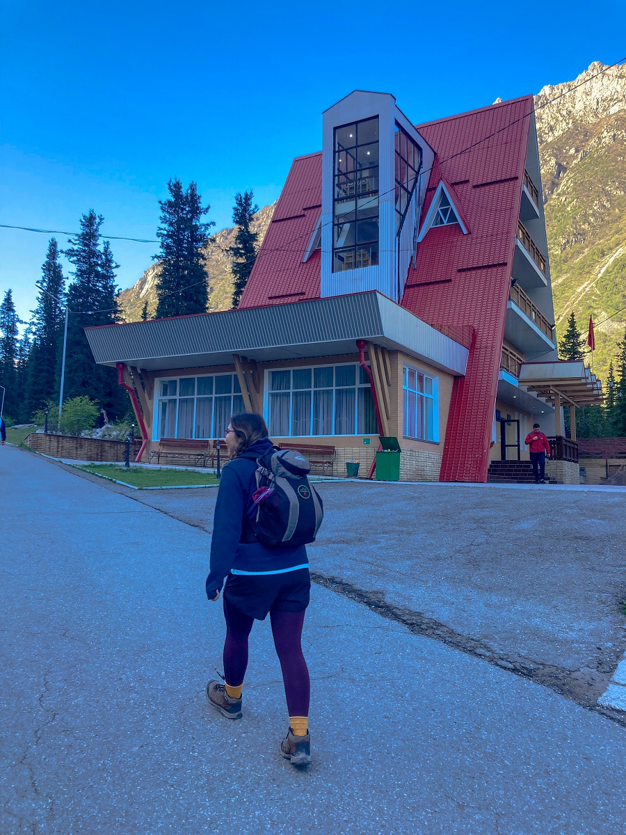
Hiking Trailhead:
The Komsomolets Peak hike begins at Alplager Hut, the same starting point used for the trail to Ratsek Hut. This A-frame building serves as a basic accommodation facility and a key landmark for hikers in Ala Archa National Park.
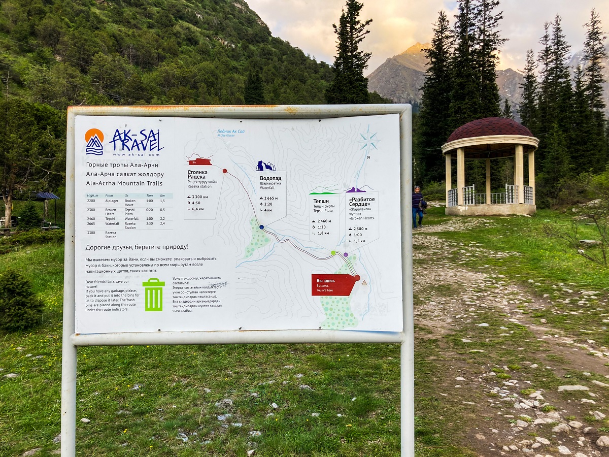
At the trailhead, you’ll find a map and information board on the left side. This marks the main route that leads toward the waterfalls and Ratsek Hut—the initial section of the trail before the path splits toward Komsomolets Peak.
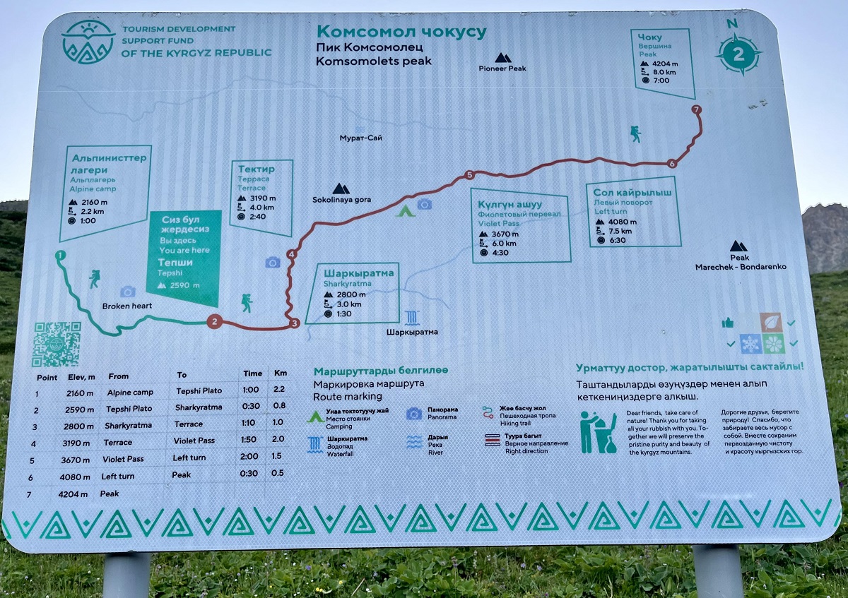
Komsomolets Peak Trail Route (Step-by-Step Guide):
The Komsomolets Peak hike originally shared the same trailhead and first sections as the route to Ratsek Hut. However, with the recent installation of the cable car in Ala Archa National Park, parts of the trail, particularly before the Broken Heart and Tepshi Plateau, have changed.
I haven’t personally revisited this hike since the change, so please note that the route described below is based on my previous hike. I’ll update this guide with the latest trail conditions once I return for a hike.
If you're planning your hike soon, it’s best to double-check with locals or recent hikers for the most accurate route.
1. Alplager Hut to Broken Heart & Tepshi Plato
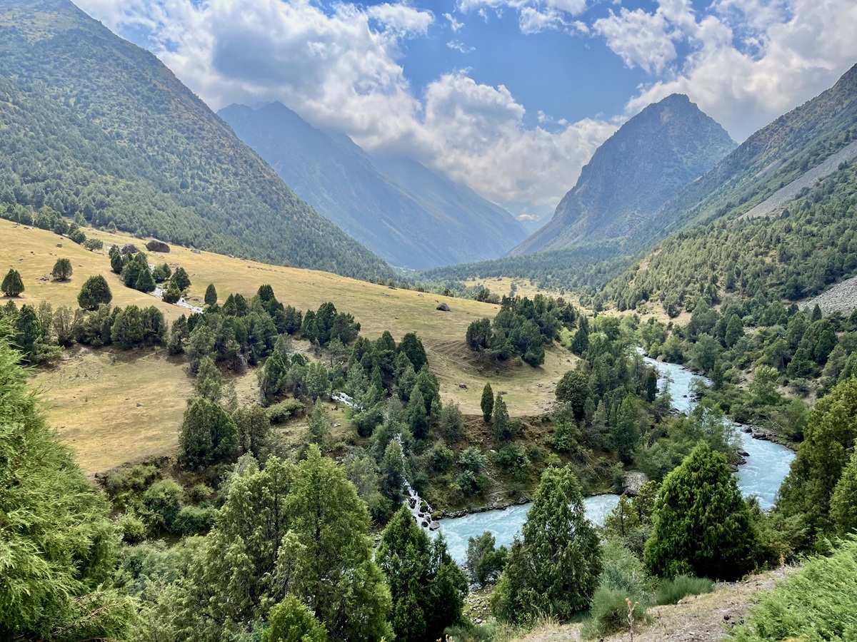
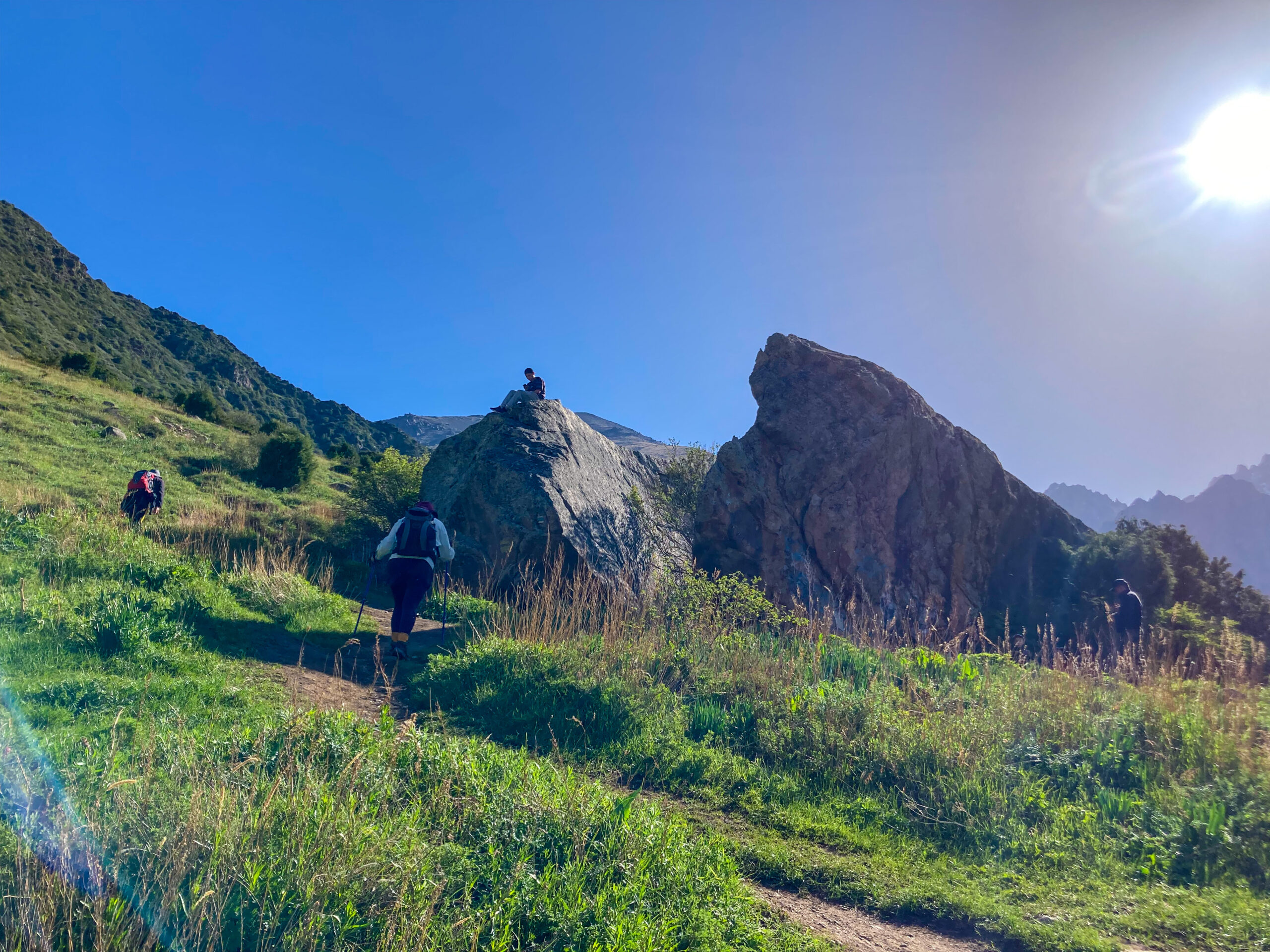
From Alplager Hut, the trail starts as a relatively easy walk through a forest of conifer trees, with the Ala Archa River flowing on your right. This section is shared with the trail to Ratsek Hut and is straightforward to follow.
After about an hour, you’ll reach the Broken Heart, a large rock naturally split into two. From here, the trail continues toward the open plateau known as Tepshi Plato, where the terrain begins to open up, and the elevation gradually increases.
2. Tepshi Plato to Sharkyratma
A short walk across Tepshi Plato brings you to a trail map for guidance.
This is also where the trail splits:
- The path to the right leads to the waterfalls and Ratsek Hut
- The path to the left leads toward Komsomolets Peak
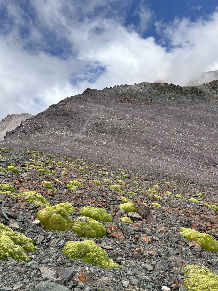
The route to Komsomolets Peak is less obvious and begins ascending the slope on the left side. This marks the end of the easier sections. Beyond this point, the climb will start to become significantly steeper.
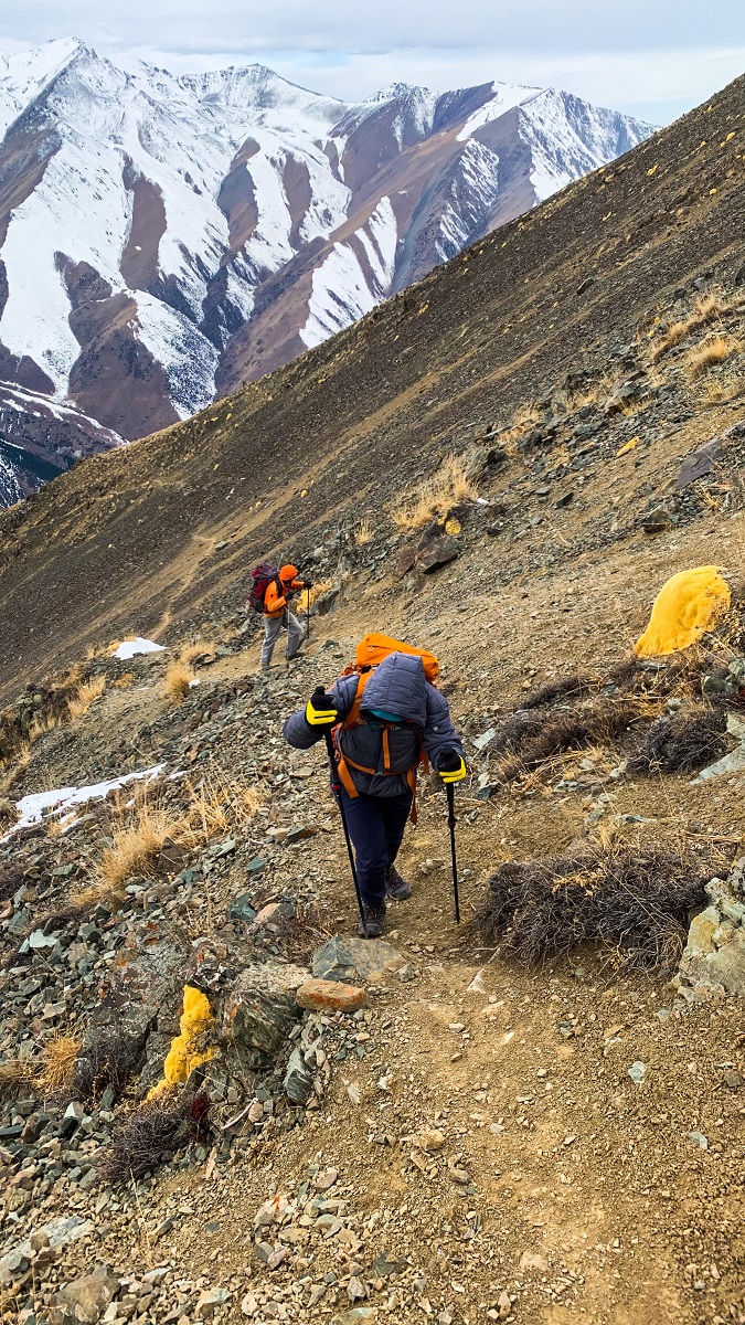
3. Sharkyratma to Terrace
This is where the real challenge begins. The trail turns into a steep, zigzag ascent over loose rocks, with little to no shade along the way. It’s a long and exposed climb until you reach a flatter section known as the Terrace.
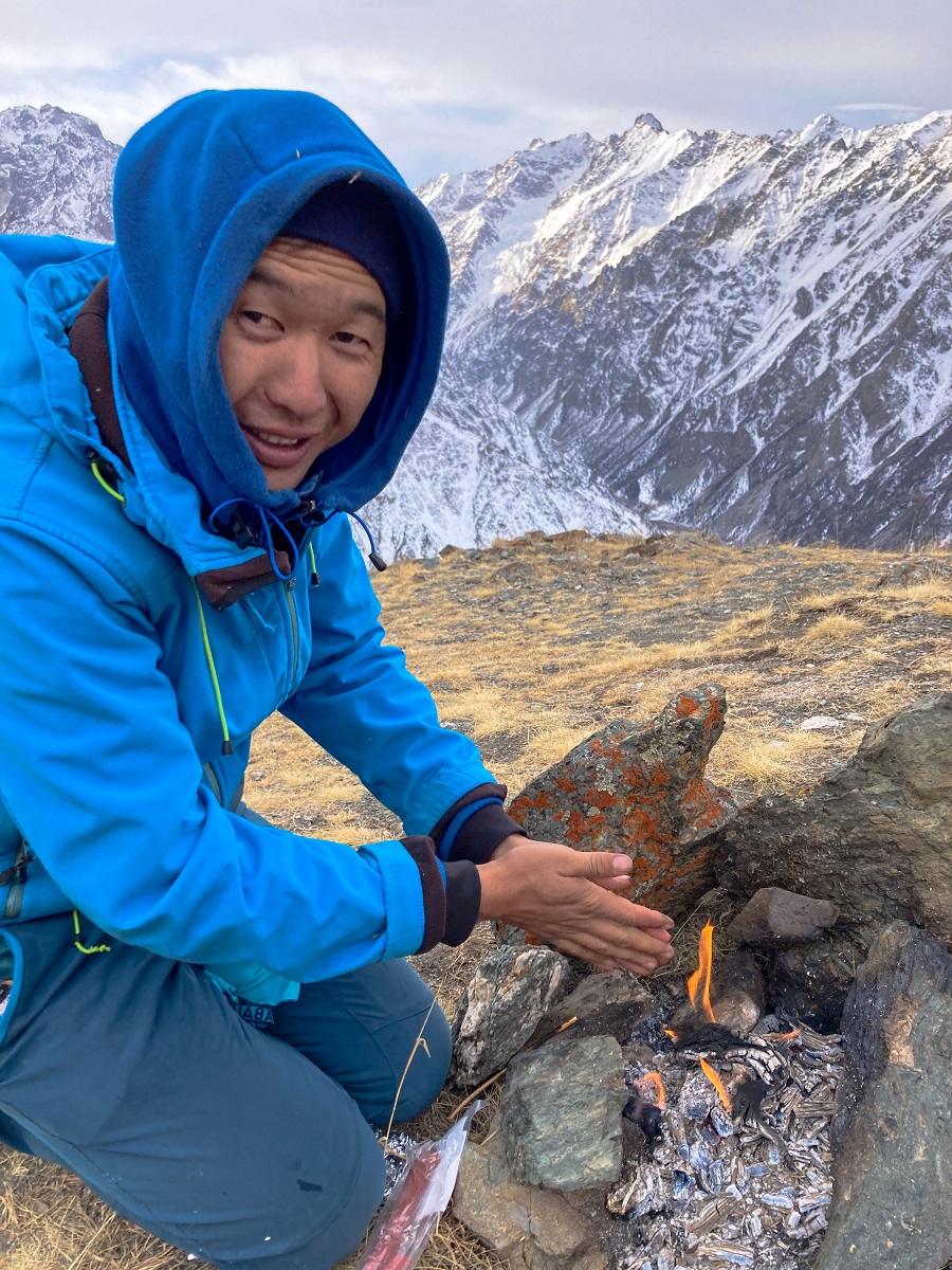
During my two attempts, we took a short break here to eat, rest, and warm up before continuing the ascent.
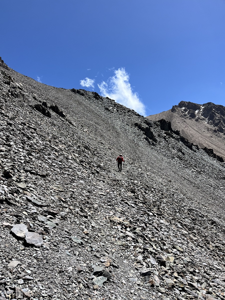
4. Terrace to Violet Pass
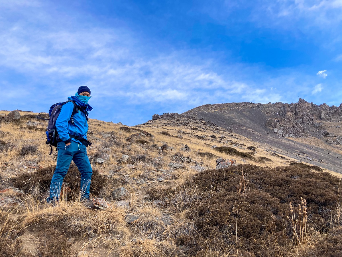
From the Terrace, the trail continues upward along steep slopes. One section I vividly remember is a narrow path along a steep incline (photo on the left) just before reaching the ridge. It wasn’t necessarily dangerous, but it did trigger some anxiety for me due to past experiences of sliding on a similar terrain.
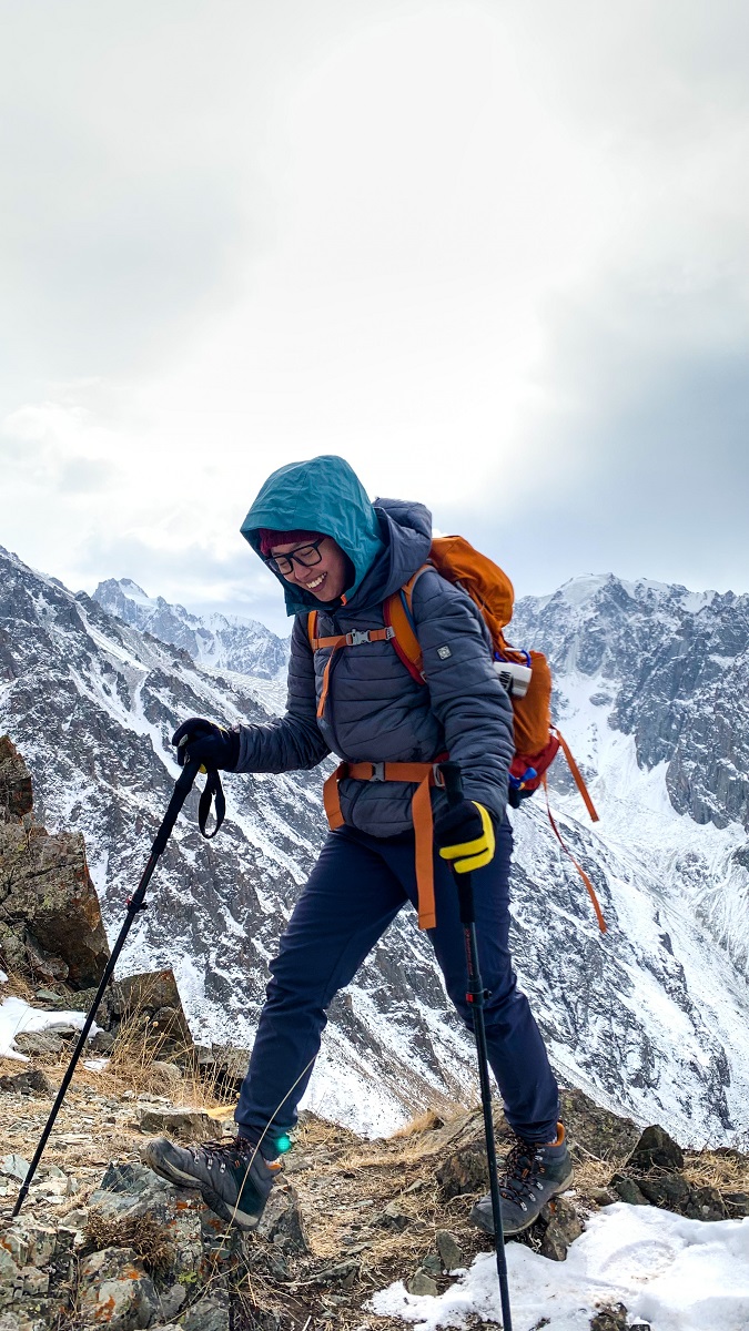
At the top, you’ll reach a small ridge (photo on the right), which was my turnaround point during my first attempt. On my second try, I pushed forward, only to realize there were still multiple ridges ahead.
Eventually, the terrain becomes slightly more forgiving as you approach Violet Pass.
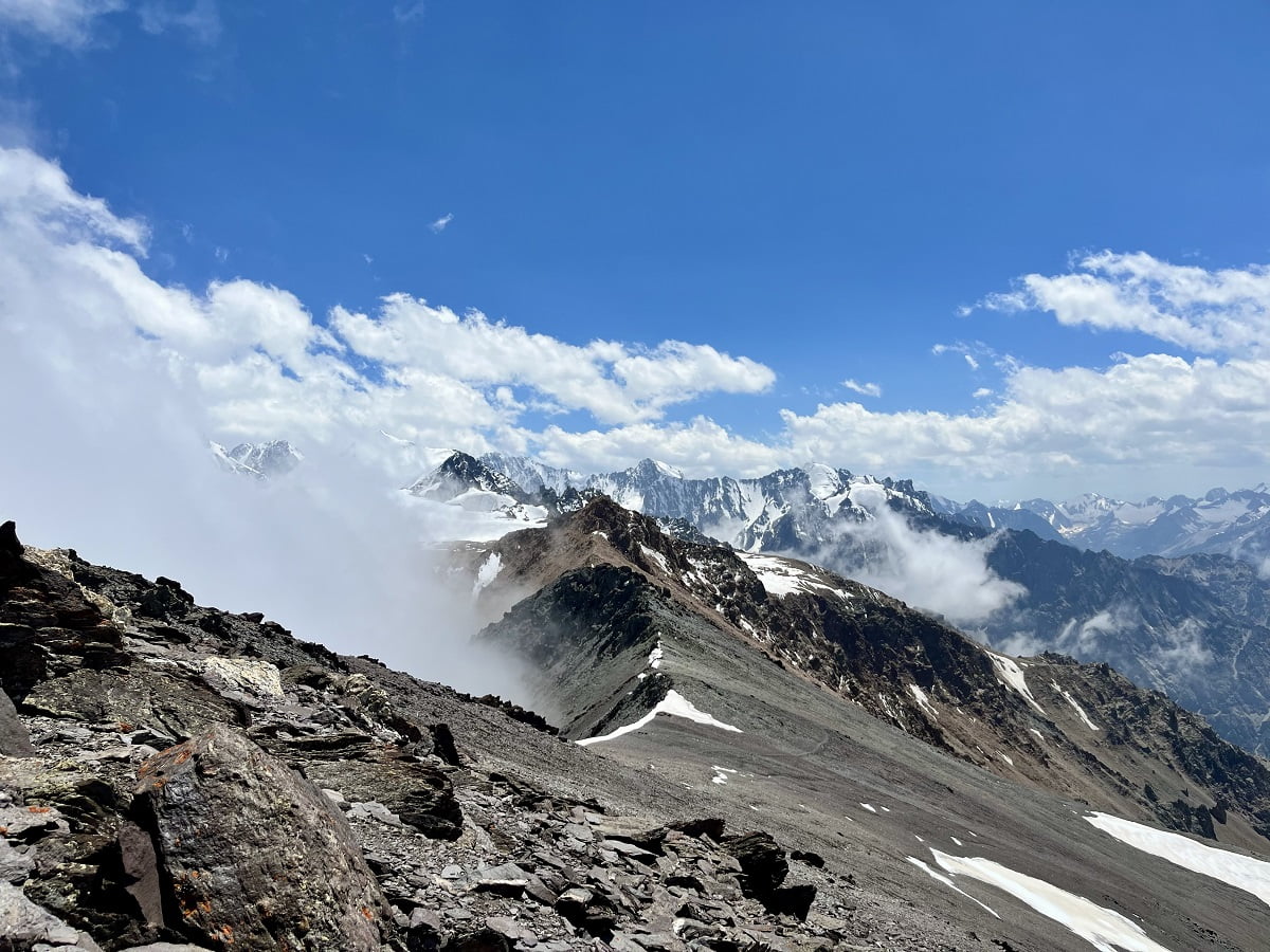
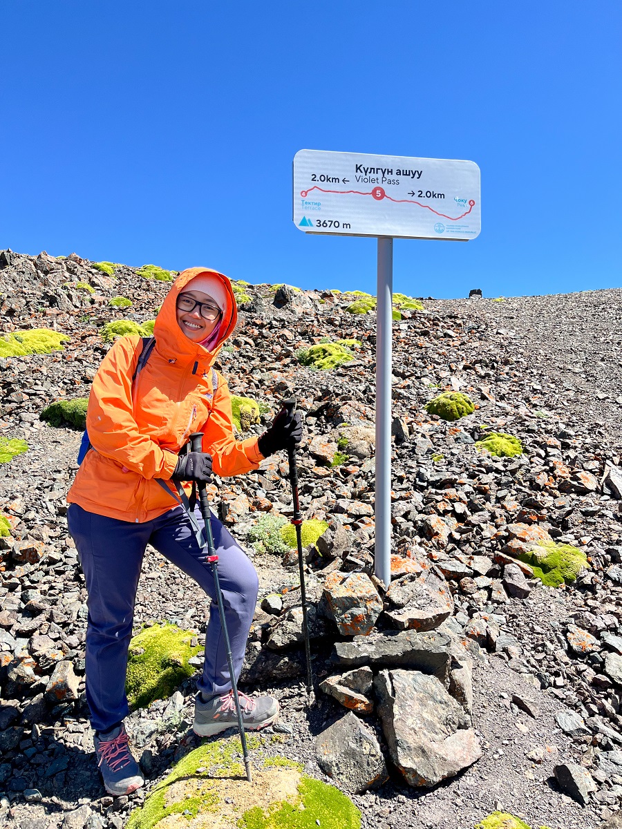
5. Violet Pass to Left Turn
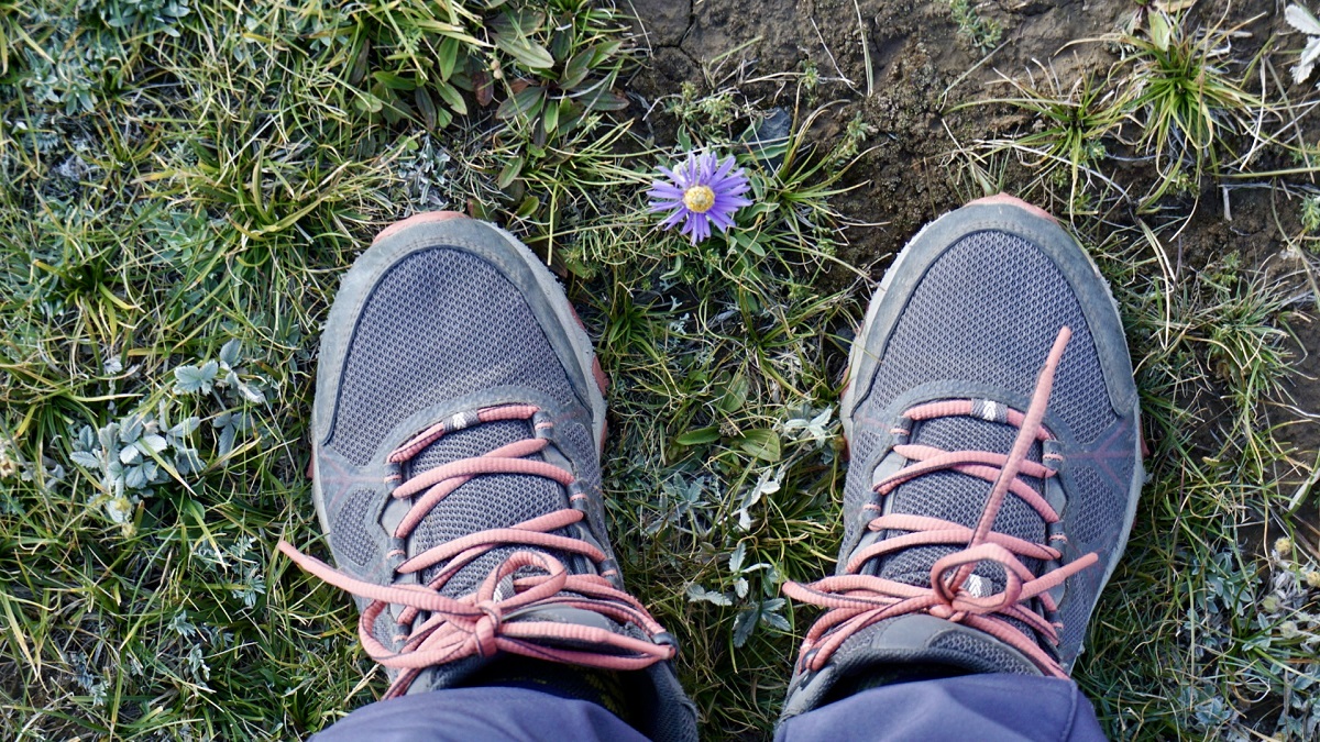
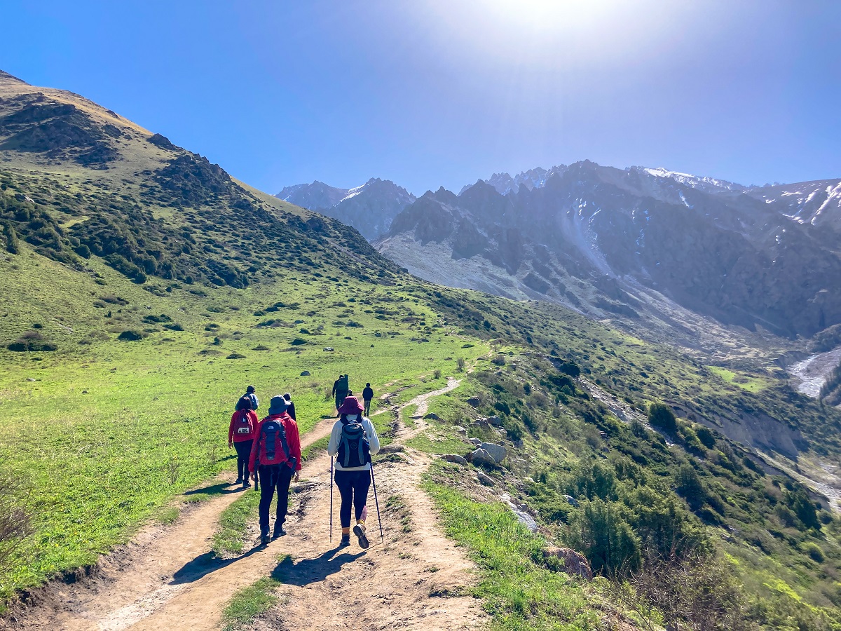
At Violet Pass, the landscape changes dramatically. Vegetation becomes scarce except for the occasional cushion plants. The terrain became rocky filled with scree and gravel. The views open up, revealing surrounding peaks and, on clear days, even a glimpse of Bishkek in the distance.
From here, the trail follows a long ridge with continuous elevation gain. It’s physically demanding, especially at this altitude. To think that I'm already slow, progress felt even more slower.
6. Left Turn to Peak
The final stretch is a mix of steep and gradual sections. While the terrain becomes less technical, the high elevation makes every step feel heavier. There was still some ice on the slope (July 2025), but not on the trail though.
I didn’t manage to take photos here because I was fully focused on keeping up and pushing through the fatigue. Thankfully, the steep climb eventually eases into a more gentle walk toward the summit.
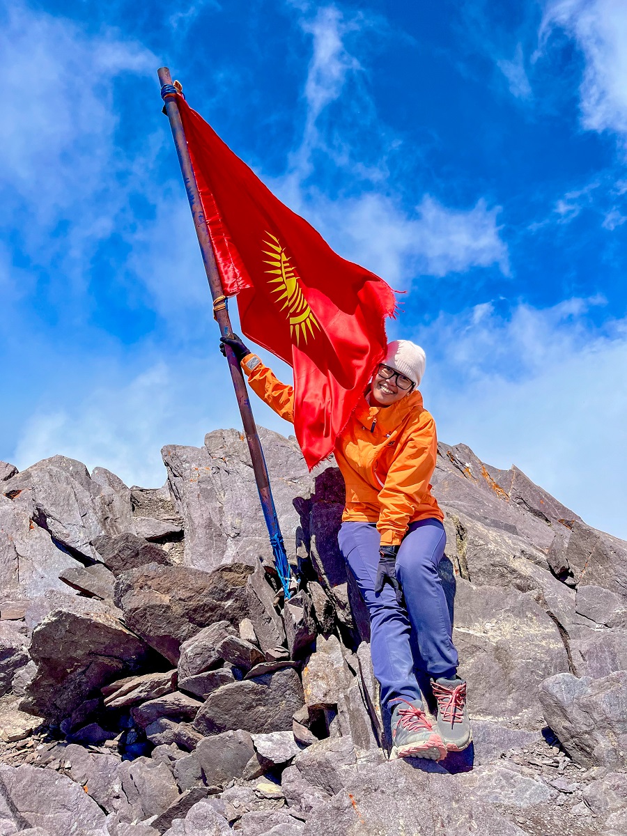
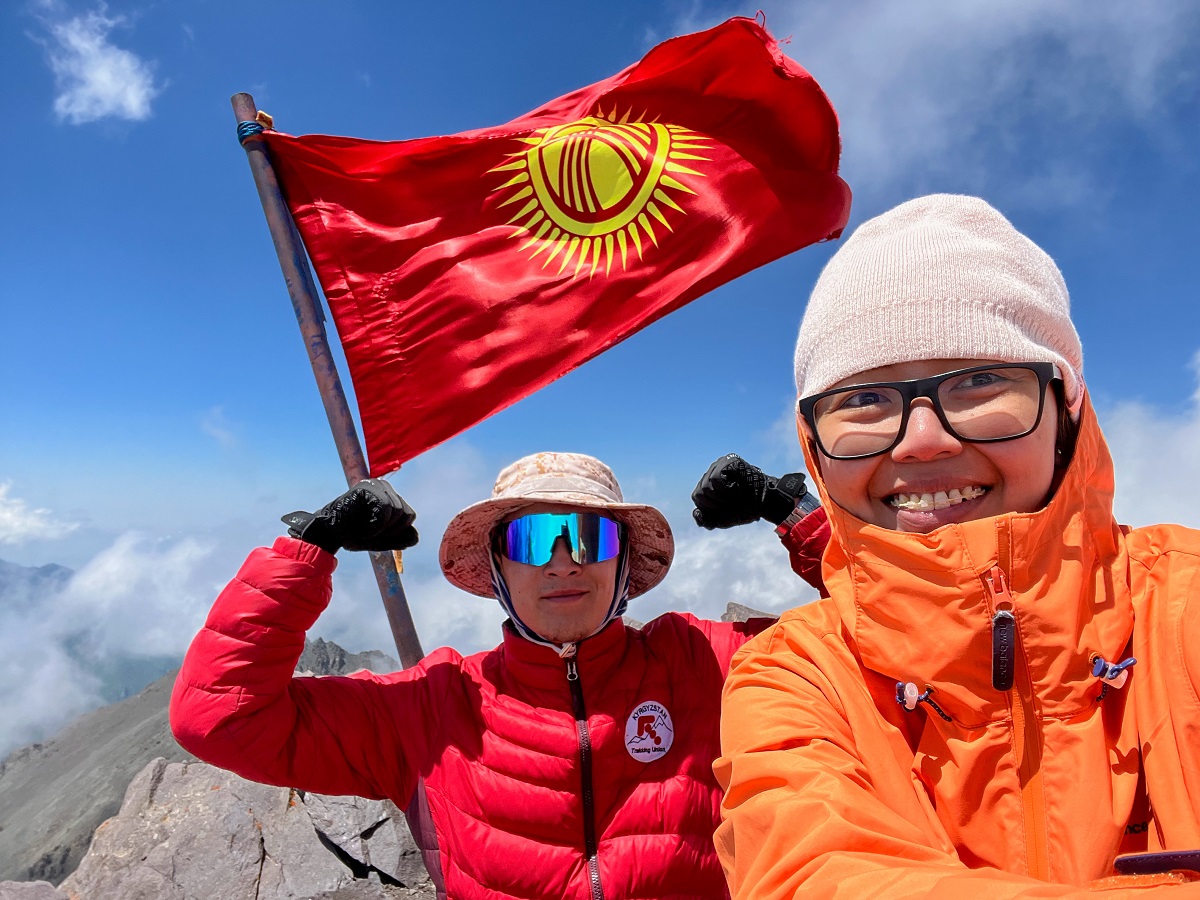
At the top, a Kyrgyzstan flag marks the peak. There’s no shelter, just rugged rocks where we sat, ate lunch, and rested for a while. After everything it took to get there, it felt surreal to finally stand at 4,200 meters.
No more unfinished business—just gratitude, relief, and a quiet moment before heading back down.
Hiking Arrangements & Contact Groups:
You can do the Komsomolets Peak hike independently, as the trail is generally established and manageable to follow—especially in the earlier sections. However, due to the elevation, long distance, and steep terrain, I personally recommend hiking with a guide if it’s your first time in Ala Archa or at high altitude.
If you prefer a guided experience, here are people I’ve personally hiked with and had a great experience:
You can hike this on your own as the trail is established and easy to follow. However, if you're interested in hiking with a guide (which I highly recommend), you may contact the following people whom I had a good experience. The links below will take you to their Instagram accounts, so take it away!
- Beka @kyrgyzgirl__ from @BeNomad – can arrange everything from guides and transportation to full tours
- Mountain Guides Jamil & Nurbolot – experienced mountain guides from the Trekking Union of Kyrgyzstan
You can contact them directly via Instagram to organize your hike.
Hiking Tips & What to Bring for Komsomolets Peak
This is a challenging high-altitude hike, so proper preparation is essential for both safety and enjoyment.
What to Bring:
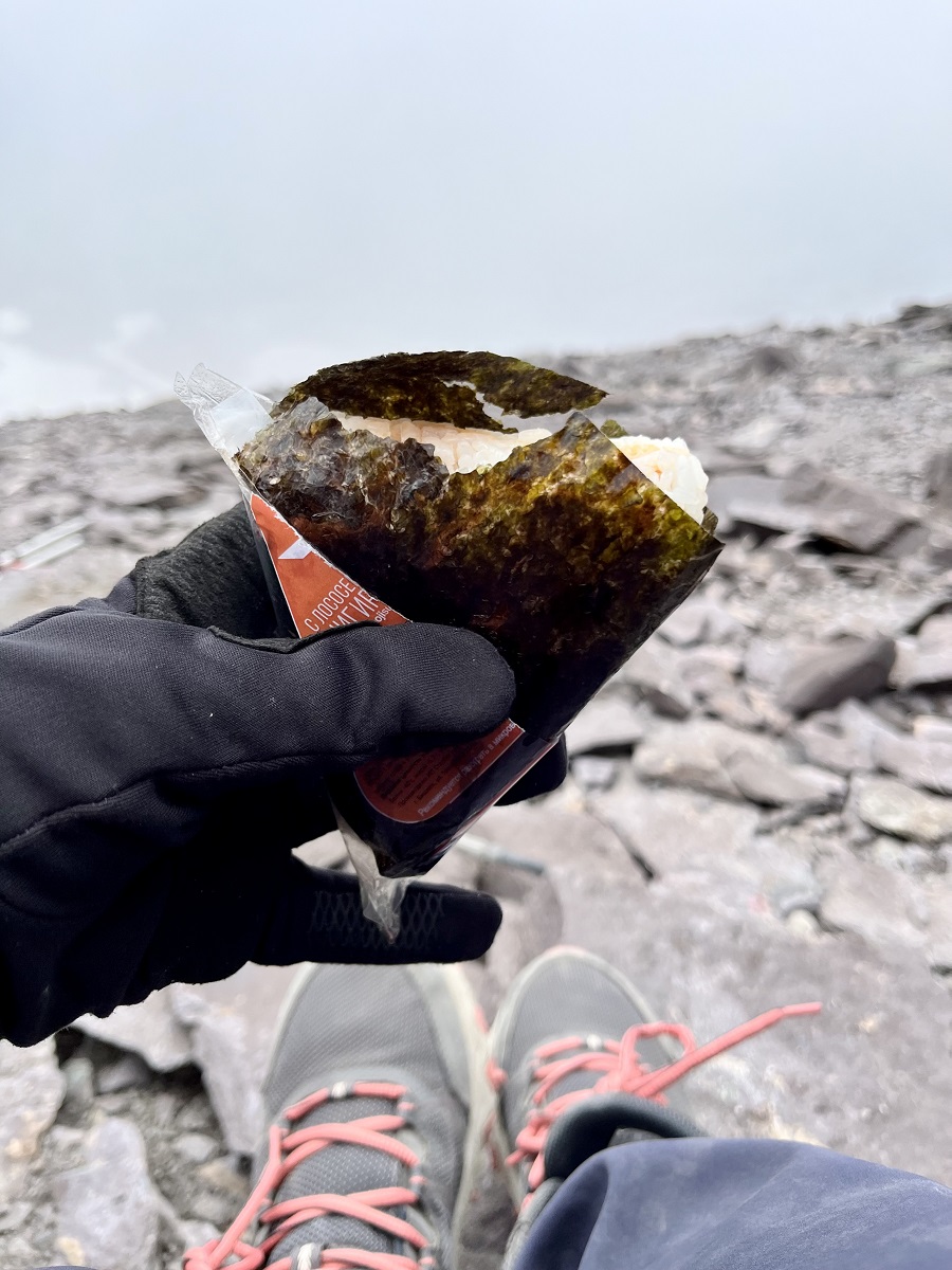
- Water and snacks – there are no facilities along the trail; bring at least 2–3 liters of water and enough food for a full-day hike
- Proper hiking boots – the trail includes loose rocks, steep ascents, and scree sections, so good grip and ankle support are important
- Trekking poles – highly recommended for the steep ascent and descent to reduce strain on your knees
- Layered clothing – temperatures drop significantly at higher elevations; bring a windproof jacket!
- Sun protection – hat, sunscreen, and sunglasses are essential, especially with little shade on the upper sections
- Offline map or GPS – download your route in advance, in case of a weak signal
- Small first aid kit – useful for minor injuries or altitude-related discomfort, bring ibuprofen for headaches due to high altitude sickness
- Trash bag – practice Leave No Trace principles
👉 I wore my Columbia Women’s Peakfreak™ II Mid Outdry Hiking Boots for this hike, and they were just right—not too heavy, not too overkill either. I shared my full review here.
Is the Komsomolets Peak Hike Worth It? (Pros & Cons)
As I always say, we all have different adventure appetites, or what I call #hikeppetite to begin with. So, a good trail for me might not be a good trail for you, and vice versa. And that’s completely okay — we don’t need to agree with anyone or everyone all the time. Anyhow, here’s what I think about my hike towards Komsomolets Peak:
Pros:
- Close to Bishkek – Ala Archa National Park is easily accessible, making this a great day hike without needing to travel far
- Reach a 4,000m peak in a day – not many places allow you to summit a four-thousander and return to the city the same day
- Non-technical climb – compared to other peaks of similar elevation, this hike doesn’t require technical mountaineering skills
- Great training hike – ideal if you're preparing for higher-altitude or alpine climbs
Cons:
- Transportation can be tricky – public transport options are limited; taxis or private transfers are more convenient but costlier
- Not beginner-friendly – the steep sections, long distance, and high elevation make this a physically demanding hike
- Risk of altitude sickness – the elevation gain is significant, especially if you’re not acclimatized
Personally, I loved the challenge of this hike. The distance, elevation gain, and overall difficulty made it incredibly rewarding. It’s exactly the kind of trail I look for when I want to push my limits without going too far from the city.
That said, the steep middle sections were no joke… and honestly, I don’t think I’m ready to face them again anytime soon. Still, reaching the summit made everything worth it.
So long, Komsomolets Peak, you were tough, humbling, and unforgettable! You're an end to my beginning! Now I’m signing off!
Whatever decision you make, always remember to prepare beforehand, stay safe, and last but not least, enjoy the outdoors! #happyhiking!
With lots of love,
PINAYHAKAWATI 💗
AND AS A GENTLE OUTDOOR ETHICS REMINDER:
LEAVE NO TRACE!
💡 Ready for more hiking adventures in Kyrgyzstan? Start exploring these trails now:
- Easiest Hiking Trail: Alamedin Gorge Loop Hike: Easy Hiking Trail Near Bishkek
- Beginner-Friendly: Ala-Archa – Scenic Hike to Ratsek Hut
- Picture-Perfect: Kol-Tor Lake – A Turquoise Lake in Kegeti
- Glacier Lake: Adygene Lake – Pristine Glacier Lake in Ala Archa National Park