Planning to hike the Big Chimgan Summit Trail in Uzbekistan? This guide covers everything you need to know. From trail difficulty, distance, elevation gain, and route sections to practical tips for hiking one of the highest peaks in the Chatkal Range near Tashkent. At over 3,200 MASL, Big Chimgan is a challenging yet rewarding day hike best suited for experienced hikers seeking altitude, endurance, and panoramic mountain views.
💡 Want more inspiration in Uzbekistan? Click on these posts and start exploring!
- Visa Guides: E-Visa
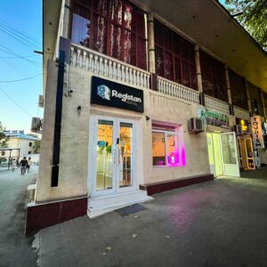
- Hostel Recommendation: Registan Hostel in Samarkand
- Train Experience(s): Sharq Train from Tashkent to Samarkand & Sleeper Train from Samarkand to Tashkent
- Train Ticket(s) Booking Guide: A Step-by-Step Guide on Booking Train Tickets with Uzbek Railways!
- Travel Story: Unboxing Uzbekistan: A Birthday Break on a Business Class on my way to Big Chimgan
Big Chimgan Summit Trail Overview & Quick Facts:
- Route: Big Chimgan Summit Trail (out-and-back)
- Distance: ~15–16 km
- Elevation Gain: ±1,600 m
- Highest Point: ~3,276 MASL
- Difficulty: Moderate to Hard (3.5/5)
- Time Required: 10–12 hours (depending on your pace)
- Best Season: June to September (avoid extreme heat and snow season)
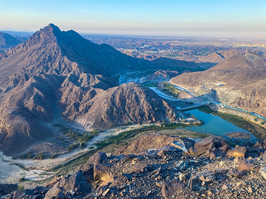
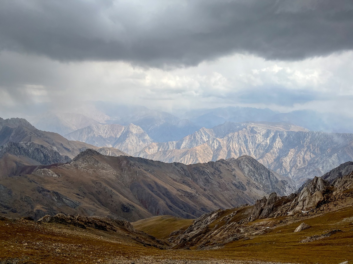
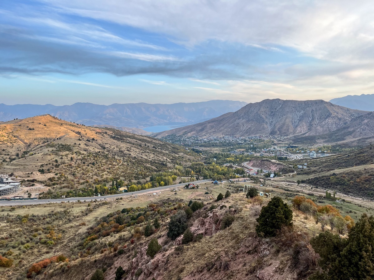
- Highlights: Panoramic views of the Chatkal Range, high-altitude summit experience, scenic ridgelines, views over Charvak Reservoir
How to Get to Big Chimgan from Tashkent:
Getting to the Big Chimgan trailhead from Tashkent requires a bit of planning, as public transportation options are limited and not very straightforward. Similar to my experiences in Kyrgyzstan, getting around involves a mix of marshrutkas (minibuses), shared taxis, and sometimes even hitchhiking.
For convenience, I opted for a private transfer arranged by my guide, Dilmurad. This allowed us to go to the trailhead without worrying about connections or navigation. It is definitely the easiest option if you're short on time.
Public Transportation Option
If you prefer a more budget-friendly (and adventurous) route, it’s still possible to reach Big Chimgan using public transport—just expect multiple transfers.
According to travel blogger Ellis of Backpack Adventure:
Take the metro to Buyuk Ipak Yoli. From there, head outside the city and take a marshrutka or shared taxi to Chirchik or Gazalkent. Then, take another shared taxi to Chimgan village. The trail jump-off point is before the village, so you can ask the driver to drop you along the way.
Getting Back to Tashkent
The Big Chimgan Summit Trail is an out-and-back route, meaning you’ll return to the same starting point.
From there, your options are:
- Hitch a ride back toward Tashkent
- Catch a shared taxi from the roadside
- Head to Chimgan village for more reliable transport options (marshrutka or shared taxi back to the city)
Public transport can be unpredictable in this area, so it’s best to start early and allow extra time for the return journey.
Big Chimgan Trailhead (Start of the Summit Hike)
The trailhead for the Big Chimgan Summit is located 3.6 km before Chimgan village and is different from the Small Chimgan trailhead, so make sure your driver knows exactly where to drop you off.
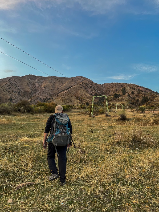
We started our hike at the coordinates below and followed the chairlift tower lines, which serve as a natural guide during the initial ascent.
📍 Trailhead Coordinates: 41.525172, 70.018007
💡 Important: There is no proper parking area directly at the trailhead. If you’re coming by car, you’ll need to drive slightly further along the road where a small parking space is available near a curve. From there, you can walk back to the starting point.
Big Chimgan Hiking Trail Sections:
Despite the long trail, I’ll break the trail sections into JUST three sections, for the sake of clarity. However, as my usual reminder, DO NOT UNDERESTIMATE THE TRAIL. Anyhow, without further adieu, let's dive in!
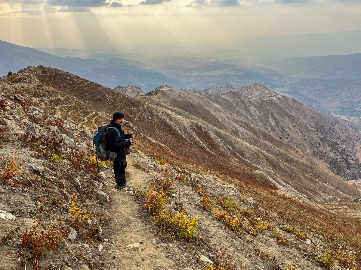
1) Chairlift Tower Line & Rolling Hills
Our hike started as we followed the trail along the direction of the chairlift towers line. The trail started nice and slow but as we approached the upper part of the hill, the trail became a little steep.
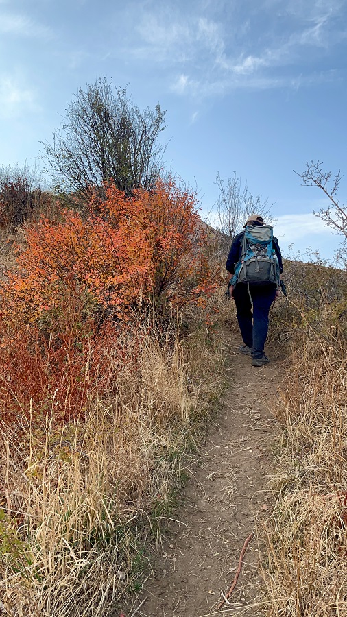
At the top of the first hill came the rolling hills which gave me plenty of rest. Small plateaus were found in between the hills where we took breaks and snacks. Unfortunately, 90% of this section has no shade at all apart from a tree (or two).
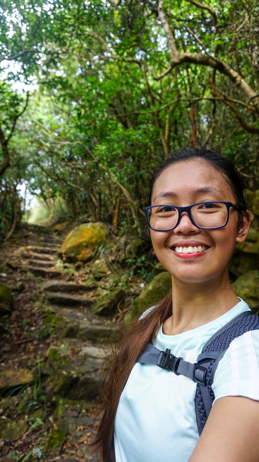
On a different note, when I hiked the Hong Kong Trail (I only managed up to Section 6), there's a famous rolling hills in Section 8 which is called the Dragon's Back (because it looks like one). I did not get the chance to witness that beauty, but I vividly remember the pictures from the Internet, and somehow the rolling hills of the Big Chimgan are the dry resemblance of the Dragon's Back. The only difference is that the Dragon's Back is of similar elevation only while the Big Chimgan picks up the elevation slowly but surely.
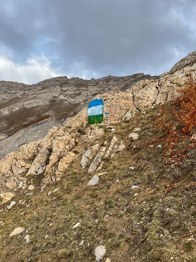
2) Rocky Terrain, Memorial & Grotto
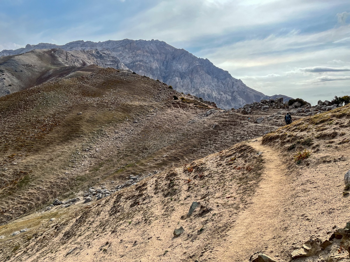
After the beautiful rolling hills is a which is similar to my playground in the UAE - Ras Al Khaimah. Dry, rocky, and loose, and with little to no vegetation at all. We've come across some lowly shrubs along the way which were all in their lovely foliage season.
A trail sign is found along the trail which resembles the flag of Uzbekistan. Once sighted, the trail is leading in the right direction where you will slightly scramble on some boulders. Right after is a very small grotto to give you some shade and comfort before the last push.
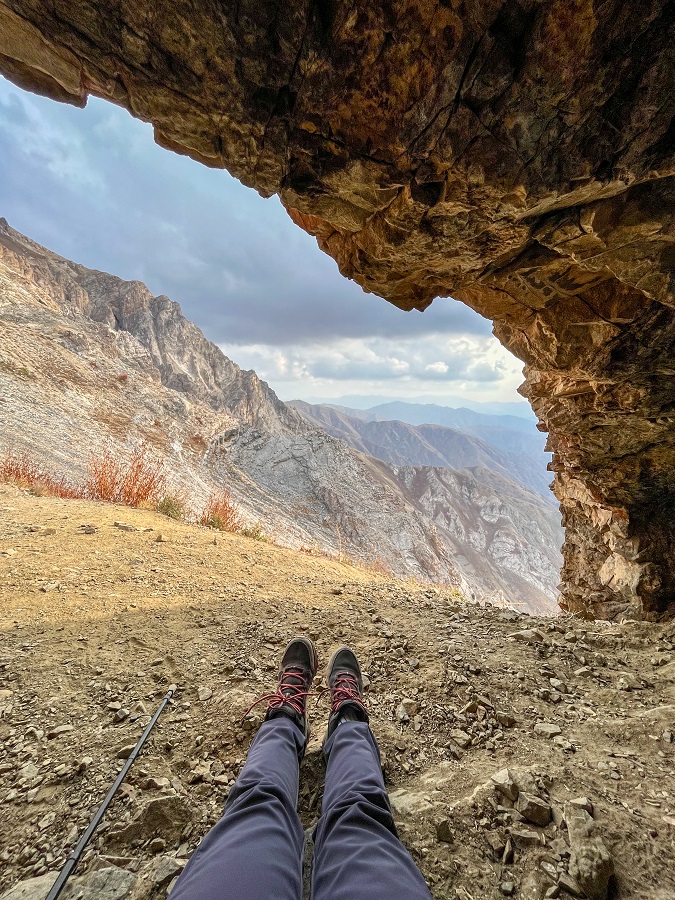
Next to the grotto is a memorial wall which is dedicated to the mountaineers and climbers who lost their lives on this particular mountain (not particularly on the same trail).

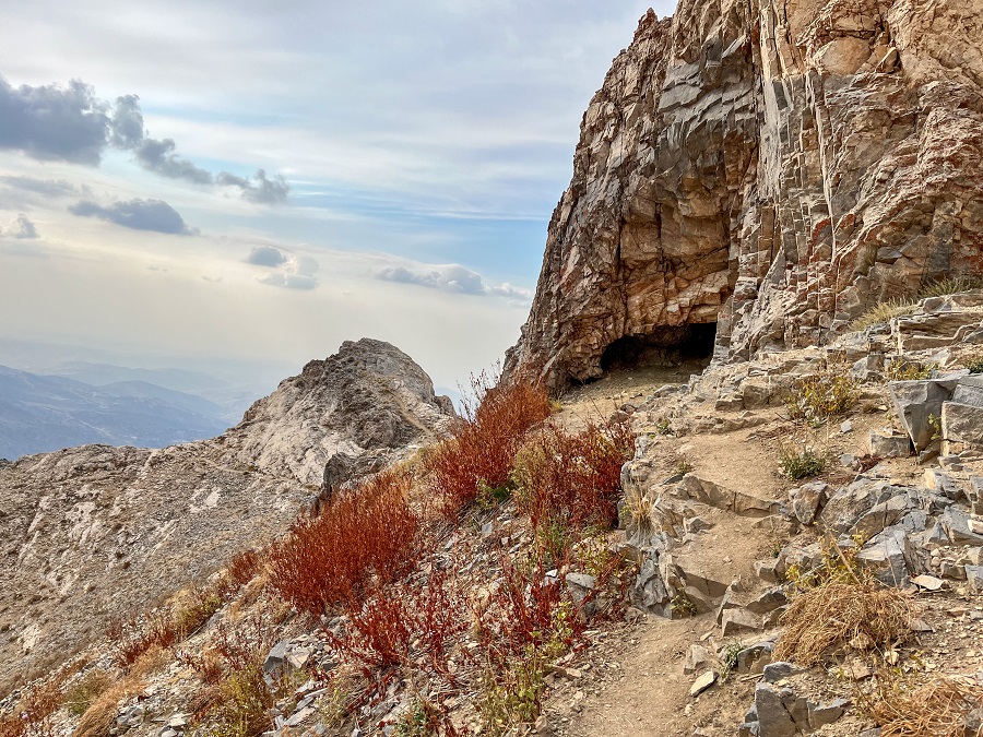
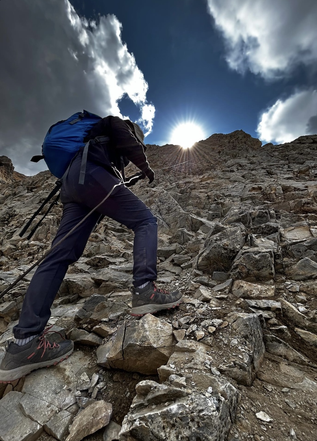
3) Rope Section and the last push above 3000 MASL!
Probably the most thrilling part of the trail is the rope section that comes next after the grotto. The first rope is a horizontal rope to support your balance while treading a short but sharp ridge. It’s only about 3-4 meters long so if your core/balance/grip is great, you don’t need the assistance of the rope.
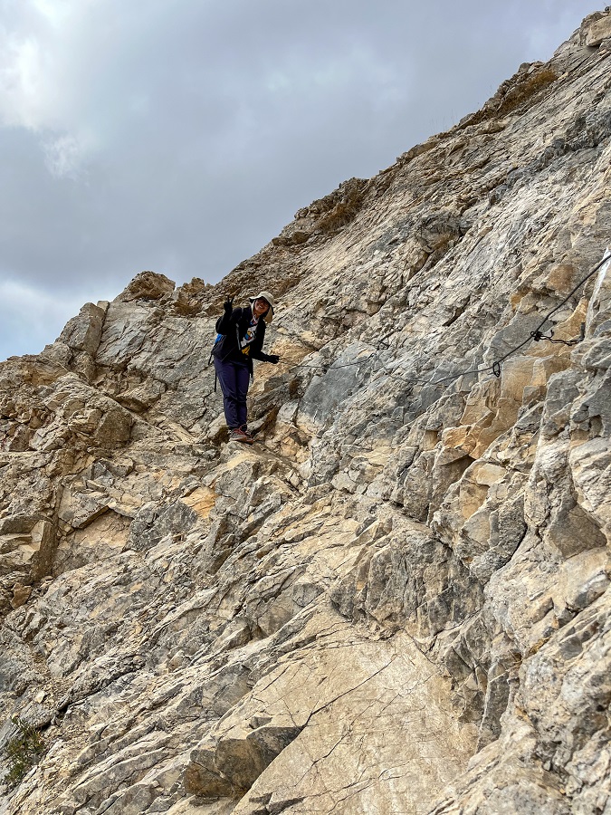
The second rope, a vertical one, is also up to your capabilities and confidence. It's the section where you will have to scramble and the rope is installed to help you pull yourself up. I didn’t want to struggle while scrambling so I used the rope while Dilmurad didn’t use the rope at all.
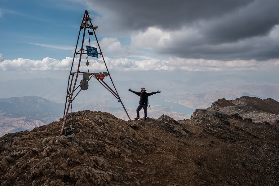
The last push to reach the summit continues to be a steep one with less oxygen at an altitude beyond 3000 MASL. I was advised that walking alone is challenging and true enough, I was sluggish until I reached the peak, but I did!
P.S. A Shortcut during Descent
On the way down, I was offered to take a 'shortcut version' to avoid the use of the vertical ropes for safety purposes. From my years and years of hiking, the shortcut option has a catch, ALWAYS. I asked Dilmurad right away what was the catch here and he told me right away that the shortcut is a loose scree.
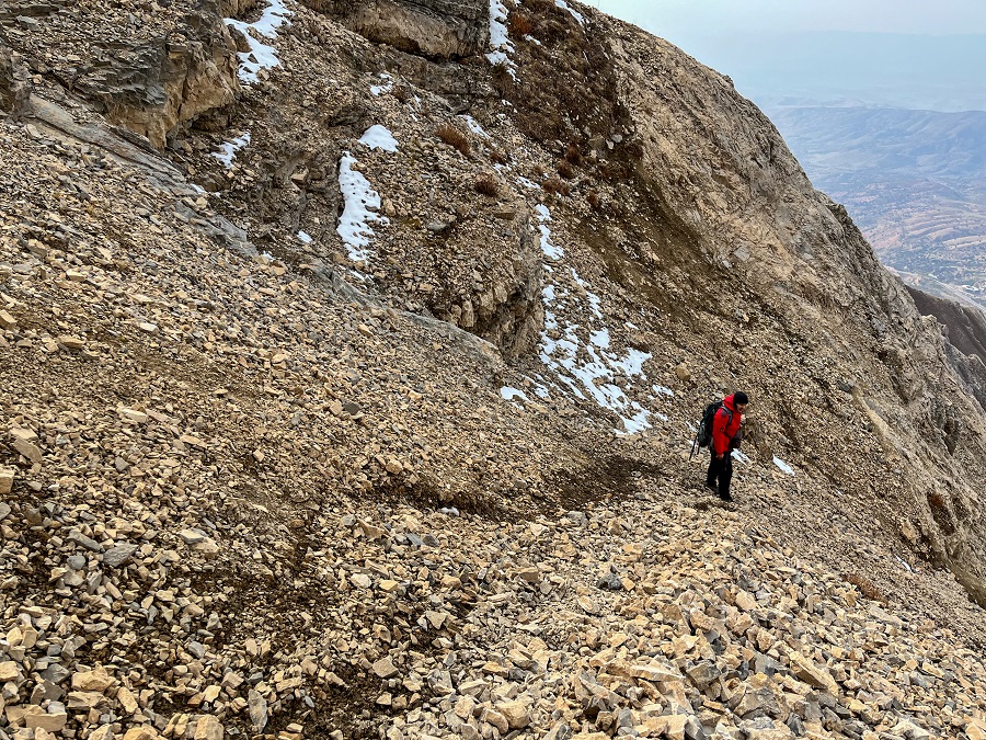
I'm very familiar with scree and it's a section I usually dread the most because of the fear of sliding down in case of a misstep. However, I took the bait and descended slowly while watching Dilmurad slide his way down. He lost his balance once in a while and I took his help from time to time on sections where I didn't feel confident at all. The scree ended at the intersection between the vertical rope which goes up and the trail going down.
Hiking Arrangements & Contact Person(s):
For this guide, I’m sharing a few local contacts you can reach out to for guiding services, transportation, or even recommendations for nearby hikes. Rates can vary depending on the season, group size, and inclusions, so don’t hesitate to ask questions and compare options.
💡 Tip: In Central Asia, pricing is often per car (not per person) unless you’re joining a group tour. If you’re traveling solo, costs may seem higher—but you can try negotiating or look for other hikers to share the ride.
Recommended Contacts
- Dilmurad Axmedov – My personal guide for this hike. I contacted him via Instagram (referred by Amirbek), and he arranged both transport and the hike. Smooth and hassle-free experience overall.
- Asia Adventures – I initially inquired with Vladimir via Telegram (+998 90 957 0300). They offer organized tours and can customize hiking trips around the Chimgan Mountains.
- Yaroslav (via Offroad Travel Club) – Another contact recommended to me, though I didn’t personally book with him.
Feel free to reach out to any of them and see what works best for your travel style and budget.
Personal Thoughts on Big Chimgan Summit Trail:
As I always say, we all have different hiking appetites, or what I like to call #hikeppetite. A trail that feels exciting and rewarding for me might feel too intense (or too easy) for someone else—and that’s completely okay.
So instead of just sharing my experience, let me also help you figure out if the Big Chimgan Summit Trail is the right hike for you.
Who Is This Hike For?
This hike is a great fit if you:
- Enjoy challenging day hikes with significant elevation gain
- Have prior hiking experience and decent endurance
- Want to reach 3,000+ MASL without doing a multi-day trek
- Are comfortable hiking in exposed conditions (no shade, no water source)
This hike is NOT ideal if you:
- Prefer short, easy, or beginner-friendly trails
- Are not used to long hikes with steep ascents
- Expect clear trail markings or facilities along the way
Pros:
- Perfect day hike from Tashkent – no need to stay overnight. We left at 5 AM and reached the trailhead by 6 AM, which made it very manageable as a day trip.
- Great altitude training – with over 1,600 m elevation gain, it’s a solid workout for your lungs and a chance to experience hiking above 3,000 MASL in a single day.
- Non-technical but still challenging – it doesn’t require climbing skills, but the distance, elevation, and exposure make it a rewarding and physically demanding hike.
Cons:
- Not for the faint-hearted – this is far from a “walk in the park.” If you’re looking for something easier, consider the Small Chimgan trail instead. In terms of effort, I’d compare this hike to trails like the Stairway to Heaven in the UAE, Jebel Shams in Oman, and Komsomolets Peak in Kyrgyzstan.
- Requires good fitness and stamina – you don’t need to be an athlete, but you should be comfortable with long hikes and sustained uphill climbs.
- No facilities along the trail – no water sources, no shade, and no shops. You’ll need to be fully self-sufficient with food, hydration, and essentials.
- Navigation can be tricky – some sections of the trail are not clearly visible, and there are no proper trail markers. While it’s possible to hike solo, I strongly recommend hiring a guide for safety and peace of mind.
Big Chimgan is the kind of hike that makes you question yourself halfway through—but also one that leaves you incredibly proud once you reach the summit. It easily became one of my most memorable hikes in 2023, and if it matches your #hikeppetite, it might just be one of yours too.
Whatever decision you make, always remember to prepare beforehand, stay safe, and last but not least, enjoy the outdoors! #happyhiking!
With lots of love,
PINAYHAKAWATI 💗
AND AS A GENTLE OUTDOOR ETHICS REMINDER:
LEAVE NO TRACE!