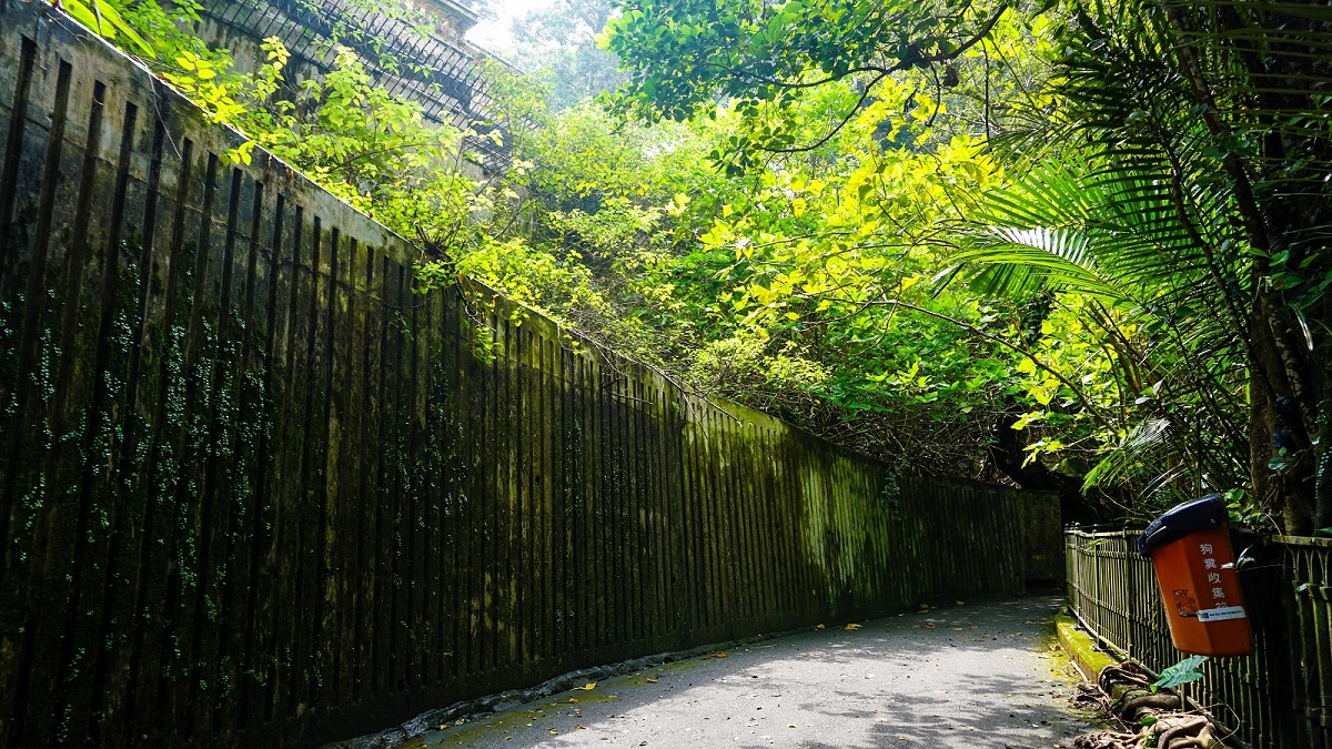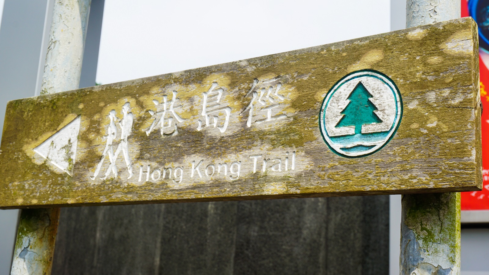
After stuffing myself with dim sum and noodles in Tsim Sha Tsui back in 2019, I finally took the courage to tackle several sections of the iconic Hong Kong Trail solo. Stretching 50 km from Victoria Peak to Big Wave Bay on Hong Kong Island, it’s one of the best long-distance hikes in the city.
At the time, comprehensive and practical online resources were scarce. So in this Hong Kong Trail guide, I’m sharing everything I learned during my experience—trail sections, maps, logistics, and tips—to help you confidently plan your own hike.
Disclaimer: Some information in this post was sourced from other blogs, and I’ve credited them appropriately. A heartfelt thanks to all contributors!
What is the Hong Kong Trail?
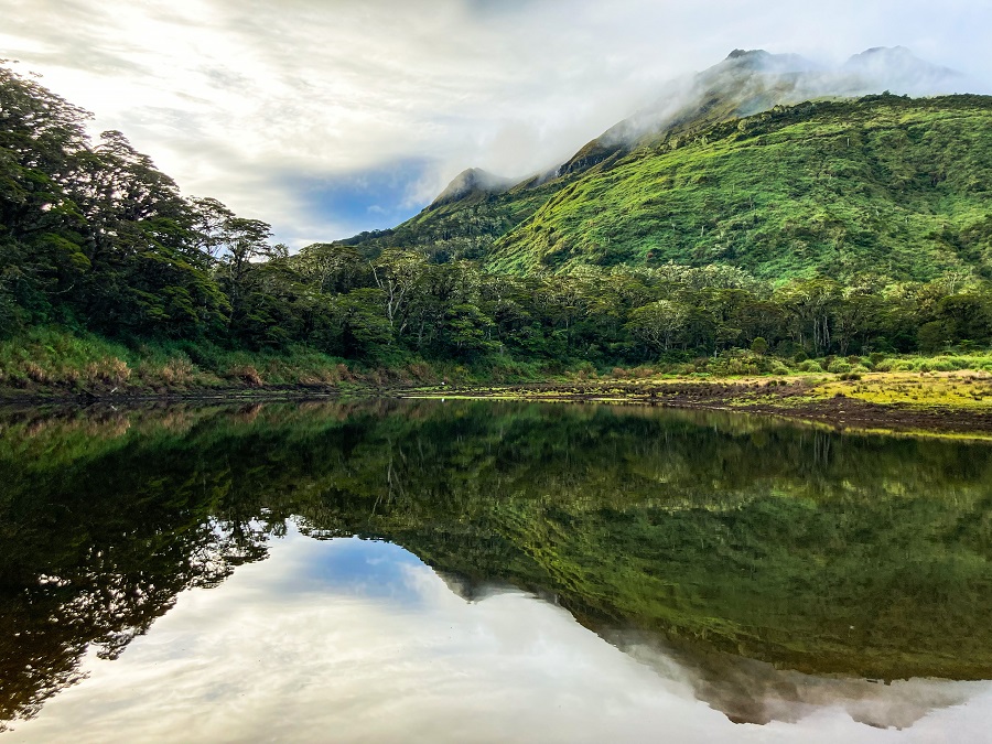
The Hong Kong Trail is a long-distance footpath spanning 50 km from Victoria Peak to Big Wave Bay, passing through five country parks on Hong Kong Island. It is a popular trail for both beginners and experienced hikers, offering a mix of lush forests, ridgelines, and city views along the way.
Hong Kong Trail Quick Facts
- Distance: 50 km
- Sections: 8
- Difficulty: Moderate
- Start: Victoria Peak
- End: Big Wave Bay
- Time Needed: 2–4 days (or section hikes)
Hong Kong Trail Hiking Sections
The trail is divided into 8 sections, each with its own difficulty, scenery, and distance.
| Section Number | Route | Distance Post Numbers | Actual Time Taken |
| Section 1 | The Peak to Pok Fu Lam Reservoir Road | #1 - #14 | 2 hours |
| Section 2 | Pok Fu Lam Reservoir Road to Peel Rise | #15 - #25 | 1 hour and 30 minutes |
| Section 3 | Peel Rise to Wan Chai Gap Road | #26 - #37 | 1 hour and 15 minutes |
| Section 4 | Wan Chai Gap Road to Won Nai Chung Road | #38 - #50 | 2 hours and 15 minutes |
| Section 5 | Won Nai Chung Road to Tai Fung Au/Mount Parker Road | #51 - #59 | 1 hour and 30 minutes |
| Section 6 | Tai Fung Au/Mount Parker Road – Tai Tam Road | #60 - #68 | 1 hour and 30 minutes |
| Section 7 | Tai Tam Road – To Tei Wan | #69 - #84 | Not yet done |
| Section 8 | To Tei Wan – Big Wave Bay | #85 - #100 | Not yet done |
Tip: While the Hong Kong Trail is the shortest of the major long-distance trails in Hong Kong, I split it across two days during my first attempt to enjoy the scenery without rushing. Extra time for detours and getting lost is highly recommended!
Other long-distance trails for reference:
- Lantau Trail (70 kilometers)
- Wilson Trail (78 kilometers)
- MacLehose Trail (100 kilometers)
Hong Kong Trail Overview (What You Need to Know)
Before you dive into the sections, here are some key factors that can make or break your hiking experience.
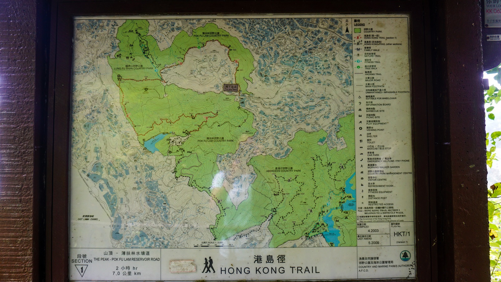
1. Trail Maps & Navigation
A reliable map is essential for any hike. Before setting out, I saved several map screenshots from different sources. To my surprise, I didn’t even need them—each section has large, detailed maps at the trailhead, showing distance markers, emergency contacts, toilets, transport options (taxi, bus, parking), and picnic spots.
Tip: Take a photo of the map before starting and familiarize yourself with basic trail map symbols.
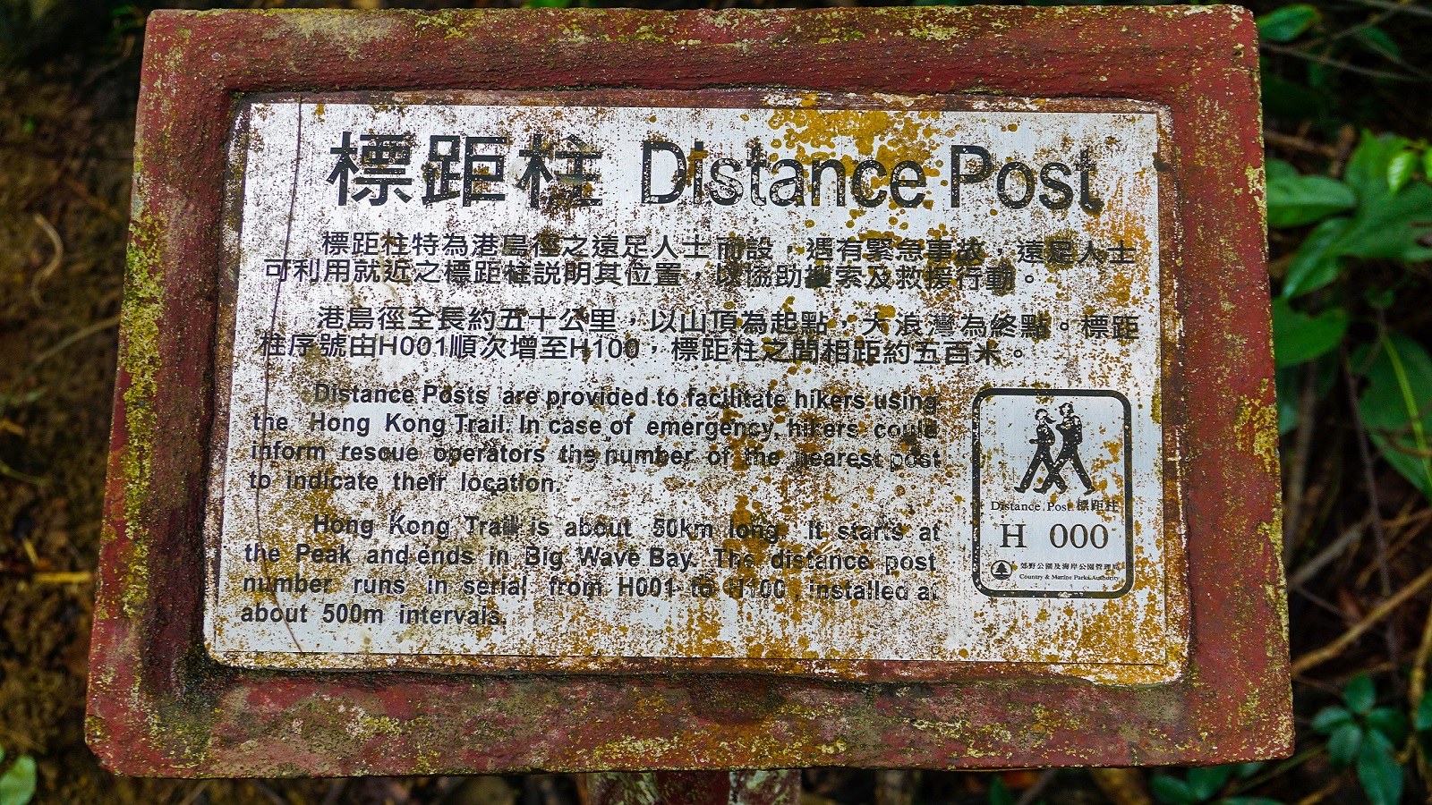
2. Distance Posts Explained
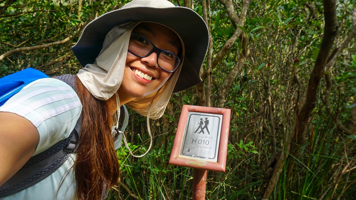
Throughout the Hong Kong Trail, you’ll notice distance posts—short metal markers with a Distance Post Number (e.g., H001) and Grid Reference. They appear every 500 meters and are useful for tracking your location and sharing coordinates during emergencies.
Tip: I photographed each distance post I passed. This helped me confirm my location and provided peace of mind in case of an emergency.
3. Water and Food Access
Some online guides mentioned places to buy food and drinks along the trail, but I didn’t come across any. While there are natural streams along the trail (I drank from one of them), I personally wouldn’t recommend relying on them unless you have proper filtration. It’s still best to carry enough water, especially during hot and humid days in Hong Kong.
Tip: Carry enough water, especially during hot and humid days, to stay safe and hydrated.
4. Camping Rules
Camping is not allowed anywhere on the trail, as indicated by signposts along the route. If you’re planning an overnight stay, this trail is not suitable.
5. Public Transportation Access
The majority of trail sections are accessible via public transport, which is a big plus compared to other Hong Kong trails that require extra walking after buses or trains.
Each section guide includes instructions on how to reach the start and exit points, based on my 2019 experience. I will continue to update this information as changes occur.
Hiking Guide of Hong Kong Trail:
Finally, let's get down to business. This pillar post breaks down into individual guides. I’ve written detailed guides for each section, including transport instructions, personal experience, and hiking tips.
You can explore the sections below (West to East):
- The Peak to Pok Fu Lam Reservoir Road (Section 1 Hiking Guide)
- Pok Fu Lam Reservoir Road to Peel Rise (Section 2 Hiking Guide)
- Peel Rise to Wan Chai Gap Road (Section 3 Hiking Guide)
- Wan Chai Gap Road to Won Nai Chung Road (Section 4 Hiking Guide)
- Won Nai Chung Road to Tai Fung Au/Mount Parker Road (Section 5 Hiking Guide)
- Tai Fung Au/Mount Parker Road to Tai Tam Road (Section 6 Hiking Guide)
And here's the thing—you can hike the sections in no particular order! It's totally up to you. Click on a section to jump straight to the detailed guide.
Final Thoughts
The Hong Kong Trail offers a perfect mix of urban accessibility and natural beauty. Whether you choose to hike a single section or complete all 50 km, proper planning, pacing, and preparation make all the difference.
Start with one section, enjoy the scenery, and you’ll likely be inspired to complete the rest!
That's all for today, and I'm closing this with my reminder:
Whatever decision you make, always remember to prepare beforehand, stay safe, and last but not least, enjoy the outdoors! #happyhiking!
With lots of love,
PINAYHAKAWATI 💗
AND AS A GENTLE OUTDOOR ETHICS REMINDER:
LEAVE NO TRACE!